You are here: Home > Network List > TA - USArray Transportable Network (new EarthScope stations) Stations List
> Station A33A Warroad, MN, USA > Earthquake Result Viewer
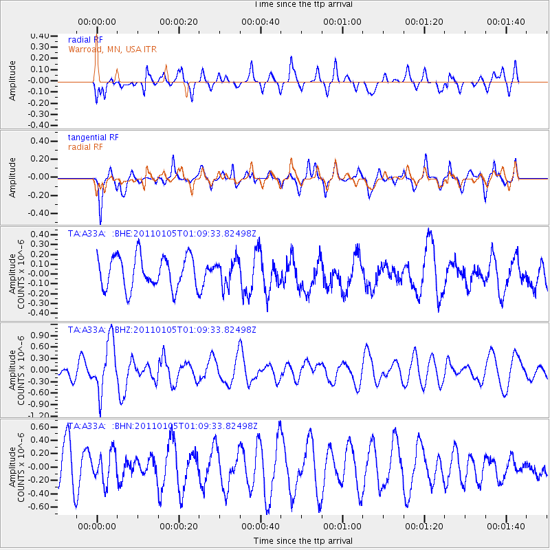
A33A Warroad, MN, USA - Earthquake Result Viewer
*The percent match for this event was below the threshold and hence no stack was calculated.
| Earthquake location: |
Southeast Of Honshu, Japan |
| Earthquake latitude/longitude: |
31.5/142.2 |
| Earthquake time(UTC): |
2011/01/05 (005) 00:57:32 GMT |
| Earthquake Depth: |
21 km |
| Earthquake Magnitude: |
6.0 MB, 5.4 MS, 5.6 MW |
| Earthquake Catalog/Contributor: |
WHDF/NEIC |
|
| Network: |
TA USArray Transportable Network (new EarthScope stations) |
| Station: |
A33A Warroad, MN, USA |
| Lat/Lon: |
48.94 N/95.39 W |
| Elevation: |
329 m |
|
| Distance: |
84.9 deg |
| Az: |
33.972 deg |
| Baz: |
313.654 deg |
| Ray Param: |
$rayparam |
*The percent match for this event was below the threshold and hence was not used in the summary stack. |
|
| Radial Match: |
50.90236 % |
| Radial Bump: |
400 |
| Transverse Match: |
65.79221 % |
| Transverse Bump: |
373 |
| SOD ConfigId: |
346946 |
| Insert Time: |
2011-07-04 13:14:36.355 +0000 |
| GWidth: |
2.5 |
| Max Bumps: |
400 |
| Tol: |
0.001 |
|
Signal To Noise
| Channel | StoN | STA | LTA |
| TA:A33A: :BHZ:20110105T01:09:33.82498Z | 2.7815962 | 6.935414E-7 | 2.4933215E-7 |
| TA:A33A: :BHN:20110105T01:09:33.82498Z | 0.8817804 | 2.3112551E-7 | 2.6211234E-7 |
| TA:A33A: :BHE:20110105T01:09:33.82498Z | 0.807264 | 1.3285376E-7 | 1.6457288E-7 |
| Arrivals |
| Ps | |
| PpPs | |
| PsPs/PpSs | |


