You are here: Home > Network List > US - United States National Seismic Network Stations List
> Station WMOK Wichita Mountains, Oklahoma, USA > Earthquake Result Viewer
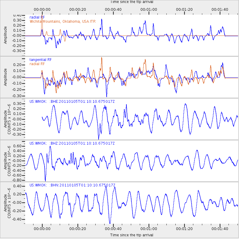
WMOK Wichita Mountains, Oklahoma, USA - Earthquake Result Viewer
*The percent match for this event was below the threshold and hence no stack was calculated.
| Earthquake location: |
Southeast Of Honshu, Japan |
| Earthquake latitude/longitude: |
31.5/142.2 |
| Earthquake time(UTC): |
2011/01/05 (005) 00:57:32 GMT |
| Earthquake Depth: |
21 km |
| Earthquake Magnitude: |
6.0 MB, 5.4 MS, 5.6 MW |
| Earthquake Catalog/Contributor: |
WHDF/NEIC |
|
| Network: |
US United States National Seismic Network |
| Station: |
WMOK Wichita Mountains, Oklahoma, USA |
| Lat/Lon: |
34.74 N/98.78 W |
| Elevation: |
486 m |
|
| Distance: |
92.6 deg |
| Az: |
46.118 deg |
| Baz: |
311.649 deg |
| Ray Param: |
$rayparam |
*The percent match for this event was below the threshold and hence was not used in the summary stack. |
|
| Radial Match: |
67.55092 % |
| Radial Bump: |
400 |
| Transverse Match: |
48.936398 % |
| Transverse Bump: |
400 |
| SOD ConfigId: |
346946 |
| Insert Time: |
2011-07-04 13:20:45.799 +0000 |
| GWidth: |
2.5 |
| Max Bumps: |
400 |
| Tol: |
0.001 |
|
Signal To Noise
| Channel | StoN | STA | LTA |
| US:WMOK: :BHZ:20110105T01:10:10.675017Z | 2.9682775 | 3.7126645E-7 | 1.2507807E-7 |
| US:WMOK: :BHN:20110105T01:10:10.675017Z | 1.2338678 | 1.9651671E-7 | 1.5926886E-7 |
| US:WMOK: :BHE:20110105T01:10:10.675017Z | 1.7645253 | 2.1349311E-7 | 1.2099181E-7 |
| Arrivals |
| Ps | |
| PpPs | |
| PsPs/PpSs | |


