You are here: Home > Network List > US - United States National Seismic Network Stations List
> Station DUG Dugway, Tooele County, Utah, USA > Earthquake Result Viewer
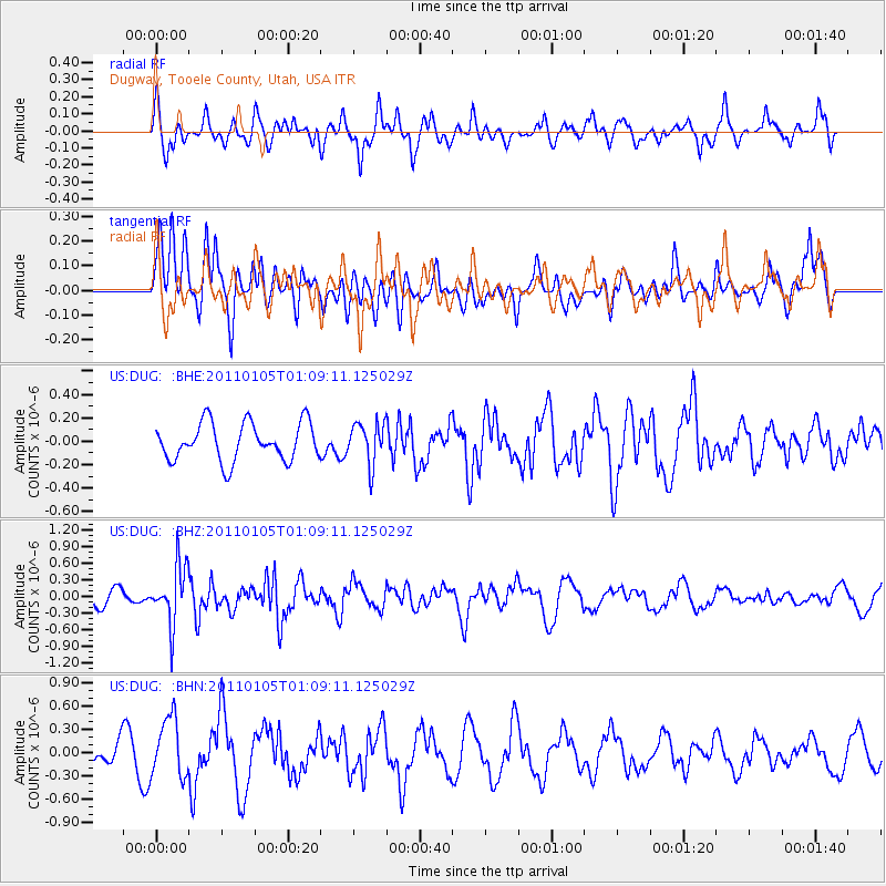
DUG Dugway, Tooele County, Utah, USA - Earthquake Result Viewer
*The percent match for this event was below the threshold and hence no stack was calculated.
| Earthquake location: |
Southeast Of Honshu, Japan |
| Earthquake latitude/longitude: |
31.5/142.2 |
| Earthquake time(UTC): |
2011/01/05 (005) 00:57:32 GMT |
| Earthquake Depth: |
21 km |
| Earthquake Magnitude: |
6.0 MB, 5.4 MS, 5.6 MW |
| Earthquake Catalog/Contributor: |
WHDF/NEIC |
|
| Network: |
US United States National Seismic Network |
| Station: |
DUG Dugway, Tooele County, Utah, USA |
| Lat/Lon: |
40.19 N/112.81 W |
| Elevation: |
1477 m |
|
| Distance: |
80.5 deg |
| Az: |
48.605 deg |
| Baz: |
303.263 deg |
| Ray Param: |
$rayparam |
*The percent match for this event was below the threshold and hence was not used in the summary stack. |
|
| Radial Match: |
56.816616 % |
| Radial Bump: |
400 |
| Transverse Match: |
51.52417 % |
| Transverse Bump: |
393 |
| SOD ConfigId: |
346946 |
| Insert Time: |
2011-07-04 13:21:27.178 +0000 |
| GWidth: |
2.5 |
| Max Bumps: |
400 |
| Tol: |
0.001 |
|
Signal To Noise
| Channel | StoN | STA | LTA |
| US:DUG: :BHZ:20110105T01:09:11.125029Z | 3.643864 | 5.2328846E-7 | 1.4360812E-7 |
| US:DUG: :BHN:20110105T01:09:11.125029Z | 3.4616637 | 3.8102138E-7 | 1.1006886E-7 |
| US:DUG: :BHE:20110105T01:09:11.125029Z | 1.1014991 | 1.7606226E-7 | 1.5983876E-7 |
| Arrivals |
| Ps | |
| PpPs | |
| PsPs/PpSs | |


