You are here: Home > Network List > US - United States National Seismic Network Stations List
> Station ELK Elko, Nevada, USA > Earthquake Result Viewer
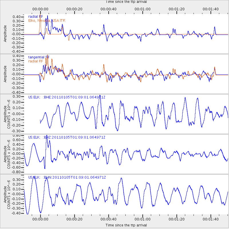
ELK Elko, Nevada, USA - Earthquake Result Viewer
*The percent match for this event was below the threshold and hence no stack was calculated.
| Earthquake location: |
Southeast Of Honshu, Japan |
| Earthquake latitude/longitude: |
31.5/142.2 |
| Earthquake time(UTC): |
2011/01/05 (005) 00:57:32 GMT |
| Earthquake Depth: |
21 km |
| Earthquake Magnitude: |
6.0 MB, 5.4 MS, 5.6 MW |
| Earthquake Catalog/Contributor: |
WHDF/NEIC |
|
| Network: |
US United States National Seismic Network |
| Station: |
ELK Elko, Nevada, USA |
| Lat/Lon: |
40.74 N/115.24 W |
| Elevation: |
2210 m |
|
| Distance: |
78.6 deg |
| Az: |
49.146 deg |
| Baz: |
301.792 deg |
| Ray Param: |
$rayparam |
*The percent match for this event was below the threshold and hence was not used in the summary stack. |
|
| Radial Match: |
62.980793 % |
| Radial Bump: |
400 |
| Transverse Match: |
78.21872 % |
| Transverse Bump: |
400 |
| SOD ConfigId: |
346946 |
| Insert Time: |
2011-07-04 13:21:34.942 +0000 |
| GWidth: |
2.5 |
| Max Bumps: |
400 |
| Tol: |
0.001 |
|
Signal To Noise
| Channel | StoN | STA | LTA |
| US:ELK: :BHZ:20110105T01:09:01.064971Z | 1.2821859 | 4.028453E-7 | 3.1418637E-7 |
| US:ELK: :BHN:20110105T01:09:01.064971Z | 1.1064756 | 2.828787E-7 | 2.556574E-7 |
| US:ELK: :BHE:20110105T01:09:01.064971Z | 1.2944989 | 1.569802E-7 | 1.2126716E-7 |
| Arrivals |
| Ps | |
| PpPs | |
| PsPs/PpSs | |


