You are here: Home > Network List > IW - Intermountain West Stations List
> Station DLMT Dillon, Montana, USA > Earthquake Result Viewer
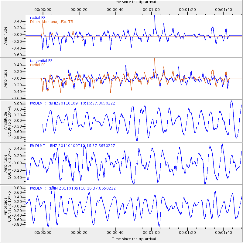
DLMT Dillon, Montana, USA - Earthquake Result Viewer
*The percent match for this event was below the threshold and hence no stack was calculated.
| Earthquake location: |
Vanuatu Islands |
| Earthquake latitude/longitude: |
-19.2/168.3 |
| Earthquake time(UTC): |
2011/01/09 (009) 10:03:44 GMT |
| Earthquake Depth: |
24 km |
| Earthquake Magnitude: |
6.1 MB, 6.4 MS, 6.6 MW, 6.5 MW |
| Earthquake Catalog/Contributor: |
WHDF/NEIC |
|
| Network: |
IW Intermountain West |
| Station: |
DLMT Dillon, Montana, USA |
| Lat/Lon: |
45.36 N/112.60 W |
| Elevation: |
1569 m |
|
| Distance: |
96.0 deg |
| Az: |
44.118 deg |
| Baz: |
248.972 deg |
| Ray Param: |
$rayparam |
*The percent match for this event was below the threshold and hence was not used in the summary stack. |
|
| Radial Match: |
40.339893 % |
| Radial Bump: |
368 |
| Transverse Match: |
59.550095 % |
| Transverse Bump: |
400 |
| SOD ConfigId: |
346946 |
| Insert Time: |
2011-07-09 07:19:13.723 +0000 |
| GWidth: |
2.5 |
| Max Bumps: |
400 |
| Tol: |
0.001 |
|
Signal To Noise
| Channel | StoN | STA | LTA |
| IW:DLMT: :BHZ:20110109T10:16:37.865022Z | 0.5903216 | 1.318079E-7 | 2.232815E-7 |
| IW:DLMT: :BHN:20110109T10:16:37.865022Z | 1.9128426 | 4.4294097E-7 | 2.3156164E-7 |
| IW:DLMT: :BHE:20110109T10:16:37.865022Z | 0.4054665 | 1.420245E-7 | 3.5027432E-7 |
| Arrivals |
| Ps | |
| PpPs | |
| PsPs/PpSs | |


