You are here: Home > Network List > CI - Caltech Regional Seismic Network Stations List
> Station BEL Belle Mtn, Joshua Tree National Park, CA, USA > Earthquake Result Viewer
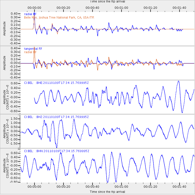
BEL Belle Mtn, Joshua Tree National Park, CA, USA - Earthquake Result Viewer
*The percent match for this event was below the threshold and hence no stack was calculated.
| Earthquake location: |
Vanuatu Islands |
| Earthquake latitude/longitude: |
-19.2/168.2 |
| Earthquake time(UTC): |
2011/01/09 (009) 17:21:51 GMT |
| Earthquake Depth: |
18 km |
| Earthquake Magnitude: |
5.7 MB, 6.1 MS, 6.2 MW, 6.1 MW |
| Earthquake Catalog/Contributor: |
WHDF/NEIC |
|
| Network: |
CI Caltech Regional Seismic Network |
| Station: |
BEL Belle Mtn, Joshua Tree National Park, CA, USA |
| Lat/Lon: |
34.00 N/116.00 W |
| Elevation: |
1388 m |
|
| Distance: |
89.4 deg |
| Az: |
53.667 deg |
| Baz: |
246.407 deg |
| Ray Param: |
$rayparam |
*The percent match for this event was below the threshold and hence was not used in the summary stack. |
|
| Radial Match: |
76.277855 % |
| Radial Bump: |
400 |
| Transverse Match: |
60.99838 % |
| Transverse Bump: |
400 |
| SOD ConfigId: |
346946 |
| Insert Time: |
2011-07-09 07:39:20.522 +0000 |
| GWidth: |
2.5 |
| Max Bumps: |
400 |
| Tol: |
0.001 |
|
Signal To Noise
| Channel | StoN | STA | LTA |
| CI:BEL: :BHZ:20110109T17:34:15.769995Z | 2.29361 | 4.004376E-7 | 1.7458837E-7 |
| CI:BEL: :BHN:20110109T17:34:15.769995Z | 0.9531151 | 2.0231123E-7 | 2.1226316E-7 |
| CI:BEL: :BHE:20110109T17:34:15.769995Z | 1.0043285 | 1.880666E-7 | 1.8725605E-7 |
| Arrivals |
| Ps | |
| PpPs | |
| PsPs/PpSs | |


