You are here: Home > Network List > TA - USArray Transportable Network (new EarthScope stations) Stations List
> Station A04D Lummi Island, WA, USA > Earthquake Result Viewer
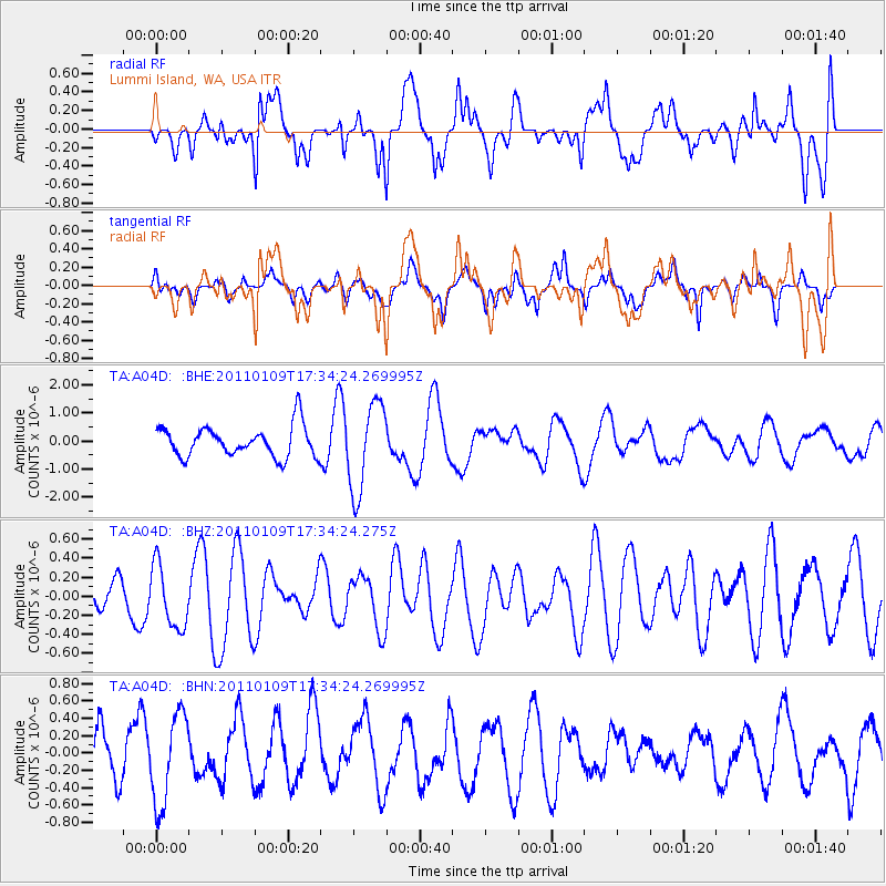
A04D Lummi Island, WA, USA - Earthquake Result Viewer
*The percent match for this event was below the threshold and hence no stack was calculated.
| Earthquake location: |
Vanuatu Islands |
| Earthquake latitude/longitude: |
-19.2/168.2 |
| Earthquake time(UTC): |
2011/01/09 (009) 17:21:51 GMT |
| Earthquake Depth: |
18 km |
| Earthquake Magnitude: |
5.7 MB, 6.1 MS, 6.2 MW, 6.1 MW |
| Earthquake Catalog/Contributor: |
WHDF/NEIC |
|
| Network: |
TA USArray Transportable Network (new EarthScope stations) |
| Station: |
A04D Lummi Island, WA, USA |
| Lat/Lon: |
48.72 N/122.71 W |
| Elevation: |
13 m |
|
| Distance: |
91.3 deg |
| Az: |
38.241 deg |
| Baz: |
242.045 deg |
| Ray Param: |
$rayparam |
*The percent match for this event was below the threshold and hence was not used in the summary stack. |
|
| Radial Match: |
56.173576 % |
| Radial Bump: |
400 |
| Transverse Match: |
71.58188 % |
| Transverse Bump: |
400 |
| SOD ConfigId: |
346946 |
| Insert Time: |
2011-07-09 07:42:53.027 +0000 |
| GWidth: |
2.5 |
| Max Bumps: |
400 |
| Tol: |
0.001 |
|
Signal To Noise
| Channel | StoN | STA | LTA |
| TA:A04D: :BHZ:20110109T17:34:24.275Z | 1.518695 | 3.344449E-7 | 2.2021861E-7 |
| TA:A04D: :BHN:20110109T17:34:24.269995Z | 1.6727853 | 5.14297E-7 | 3.074495E-7 |
| TA:A04D: :BHE:20110109T17:34:24.269995Z | 2.9021244 | 1.5829181E-6 | 5.454343E-7 |
| Arrivals |
| Ps | |
| PpPs | |
| PsPs/PpSs | |


