You are here: Home > Network List > TA - USArray Transportable Network (new EarthScope stations) Stations List
> Station K35A Storm Lake, IA, USA > Earthquake Result Viewer
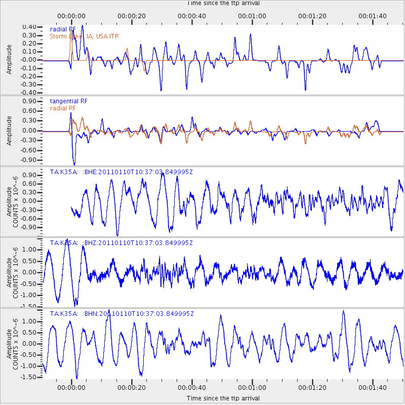
K35A Storm Lake, IA, USA - Earthquake Result Viewer
*The percent match for this event was below the threshold and hence no stack was calculated.
| Earthquake location: |
Volcano Islands, Japan Region |
| Earthquake latitude/longitude: |
23.1/143.2 |
| Earthquake time(UTC): |
2011/01/10 (010) 10:24:20 GMT |
| Earthquake Depth: |
87 km |
| Earthquake Magnitude: |
5.7 MB, 5.6 MW, 5.6 MW |
| Earthquake Catalog/Contributor: |
WHDF/NEIC |
|
| Network: |
TA USArray Transportable Network (new EarthScope stations) |
| Station: |
K35A Storm Lake, IA, USA |
| Lat/Lon: |
42.72 N/95.23 W |
| Elevation: |
439 m |
|
| Distance: |
95.3 deg |
| Az: |
39.074 deg |
| Baz: |
308.031 deg |
| Ray Param: |
$rayparam |
*The percent match for this event was below the threshold and hence was not used in the summary stack. |
|
| Radial Match: |
56.66001 % |
| Radial Bump: |
400 |
| Transverse Match: |
76.27632 % |
| Transverse Bump: |
400 |
| SOD ConfigId: |
346946 |
| Insert Time: |
2011-07-09 08:20:00.248 +0000 |
| GWidth: |
2.5 |
| Max Bumps: |
400 |
| Tol: |
0.001 |
|
Signal To Noise
| Channel | StoN | STA | LTA |
| TA:K35A: :BHZ:20110110T10:37:03.849995Z | 1.9357489 | 9.0714747E-7 | 4.6862868E-7 |
| TA:K35A: :BHN:20110110T10:37:03.849995Z | 1.4954932 | 7.737019E-7 | 5.1735566E-7 |
| TA:K35A: :BHE:20110110T10:37:03.849995Z | 1.4935299 | 7.0359823E-7 | 4.7109754E-7 |
| Arrivals |
| Ps | |
| PpPs | |
| PsPs/PpSs | |


