You are here: Home > Network List > US - United States National Seismic Network Stations List
> Station EGMT Eagleton, Montana, USA > Earthquake Result Viewer
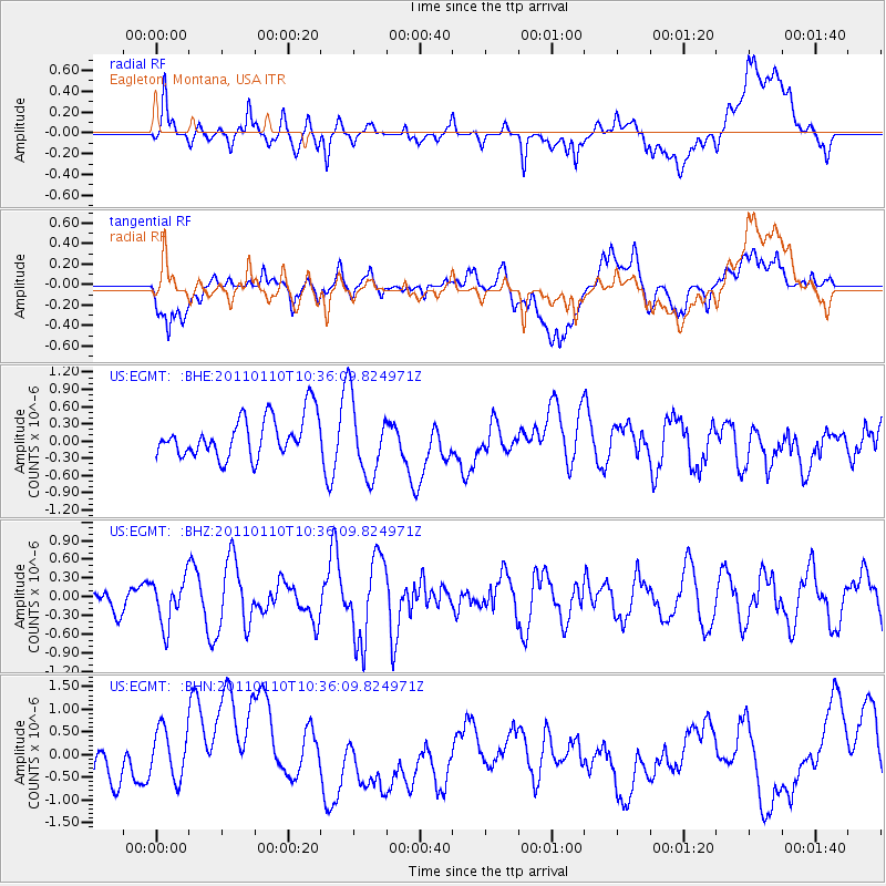
EGMT Eagleton, Montana, USA - Earthquake Result Viewer
*The percent match for this event was below the threshold and hence no stack was calculated.
| Earthquake location: |
Volcano Islands, Japan Region |
| Earthquake latitude/longitude: |
23.1/143.2 |
| Earthquake time(UTC): |
2011/01/10 (010) 10:24:20 GMT |
| Earthquake Depth: |
87 km |
| Earthquake Magnitude: |
5.7 MB, 5.6 MW, 5.6 MW |
| Earthquake Catalog/Contributor: |
WHDF/NEIC |
|
| Network: |
US United States National Seismic Network |
| Station: |
EGMT Eagleton, Montana, USA |
| Lat/Lon: |
48.02 N/109.75 W |
| Elevation: |
1055 m |
|
| Distance: |
83.8 deg |
| Az: |
40.198 deg |
| Baz: |
297.7 deg |
| Ray Param: |
$rayparam |
*The percent match for this event was below the threshold and hence was not used in the summary stack. |
|
| Radial Match: |
51.9611 % |
| Radial Bump: |
400 |
| Transverse Match: |
32.961826 % |
| Transverse Bump: |
400 |
| SOD ConfigId: |
346946 |
| Insert Time: |
2011-07-09 08:22:06.045 +0000 |
| GWidth: |
2.5 |
| Max Bumps: |
400 |
| Tol: |
0.001 |
|
Signal To Noise
| Channel | StoN | STA | LTA |
| US:EGMT: :BHZ:20110110T10:36:09.824971Z | 2.2752917 | 3.6296075E-7 | 1.5952274E-7 |
| US:EGMT: :BHN:20110110T10:36:09.824971Z | 1.6862661 | 6.64579E-7 | 3.9411276E-7 |
| US:EGMT: :BHE:20110110T10:36:09.824971Z | 1.9026262 | 6.6457403E-7 | 3.49293E-7 |
| Arrivals |
| Ps | |
| PpPs | |
| PsPs/PpSs | |


