You are here: Home > Network List > BK - Berkeley Digital Seismograph Network Stations List
> Station SAO San Andreas Geophysical Obs., Hollister, CA, USA > Earthquake Result Viewer
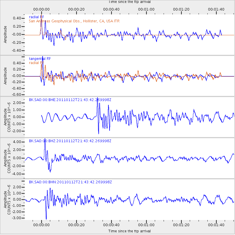
SAO San Andreas Geophysical Obs., Hollister, CA, USA - Earthquake Result Viewer
*The percent match for this event was below the threshold and hence no stack was calculated.
| Earthquake location: |
Bonin Islands, Japan Region |
| Earthquake latitude/longitude: |
27.0/139.9 |
| Earthquake time(UTC): |
2011/01/12 (012) 21:32:55 GMT |
| Earthquake Depth: |
528 km |
| Earthquake Magnitude: |
6.2 MB, 6.5 MW, 6.5 MW |
| Earthquake Catalog/Contributor: |
WHDF/NEIC |
|
| Network: |
BK Berkeley Digital Seismograph Network |
| Station: |
SAO San Andreas Geophysical Obs., Hollister, CA, USA |
| Lat/Lon: |
36.76 N/121.45 W |
| Elevation: |
317 m |
|
| Distance: |
80.8 deg |
| Az: |
53.541 deg |
| Baz: |
296.646 deg |
| Ray Param: |
$rayparam |
*The percent match for this event was below the threshold and hence was not used in the summary stack. |
|
| Radial Match: |
64.127205 % |
| Radial Bump: |
400 |
| Transverse Match: |
71.69127 % |
| Transverse Bump: |
400 |
| SOD ConfigId: |
346946 |
| Insert Time: |
2011-07-09 08:43:14.164 +0000 |
| GWidth: |
2.5 |
| Max Bumps: |
400 |
| Tol: |
0.001 |
|
Signal To Noise
| Channel | StoN | STA | LTA |
| BK:SAO:00:BHZ:20110112T21:43:42.269998Z | 7.8859086 | 1.748293E-6 | 2.2169836E-7 |
| BK:SAO:00:BHN:20110112T21:43:42.269998Z | 4.3859725 | 1.0091304E-6 | 2.3008134E-7 |
| BK:SAO:00:BHE:20110112T21:43:42.269998Z | 3.0451899 | 1.0503157E-6 | 3.4490978E-7 |
| Arrivals |
| Ps | |
| PpPs | |
| PsPs/PpSs | |


