You are here: Home > Network List > MN - MEDNET Project Stations List
> Station VTS Vitosha, Bulgary > Earthquake Result Viewer
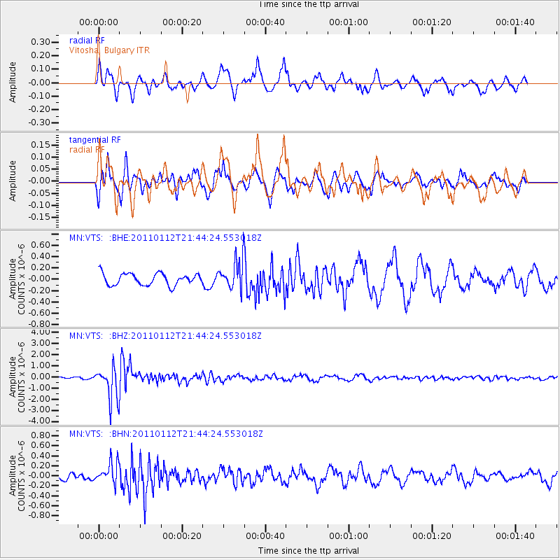
VTS Vitosha, Bulgary - Earthquake Result Viewer
*The percent match for this event was below the threshold and hence no stack was calculated.
| Earthquake location: |
Bonin Islands, Japan Region |
| Earthquake latitude/longitude: |
27.0/139.9 |
| Earthquake time(UTC): |
2011/01/12 (012) 21:32:55 GMT |
| Earthquake Depth: |
528 km |
| Earthquake Magnitude: |
6.2 MB, 6.5 MW, 6.5 MW |
| Earthquake Catalog/Contributor: |
WHDF/NEIC |
|
| Network: |
MN MEDNET Project |
| Station: |
VTS Vitosha, Bulgary |
| Lat/Lon: |
42.62 N/23.24 E |
| Elevation: |
1490 m |
|
| Distance: |
89.5 deg |
| Az: |
318.712 deg |
| Baz: |
52.915 deg |
| Ray Param: |
$rayparam |
*The percent match for this event was below the threshold and hence was not used in the summary stack. |
|
| Radial Match: |
76.03816 % |
| Radial Bump: |
400 |
| Transverse Match: |
76.16877 % |
| Transverse Bump: |
400 |
| SOD ConfigId: |
346946 |
| Insert Time: |
2011-07-09 09:05:35.681 +0000 |
| GWidth: |
2.5 |
| Max Bumps: |
400 |
| Tol: |
0.001 |
|
Signal To Noise
| Channel | StoN | STA | LTA |
| MN:VTS: :BHZ:20110112T21:44:24.553018Z | 14.812638 | 1.547098E-6 | 1.0444446E-7 |
| MN:VTS: :BHN:20110112T21:44:24.553018Z | 3.4605951 | 2.1958152E-7 | 6.345196E-8 |
| MN:VTS: :BHE:20110112T21:44:24.553018Z | 2.6248624 | 2.7286384E-7 | 1.0395358E-7 |
| Arrivals |
| Ps | |
| PpPs | |
| PsPs/PpSs | |


