You are here: Home > Network List > TA - USArray Transportable Network (new EarthScope stations) Stations List
> Station S56A Natural Bridge, VA, USA > Earthquake Result Viewer
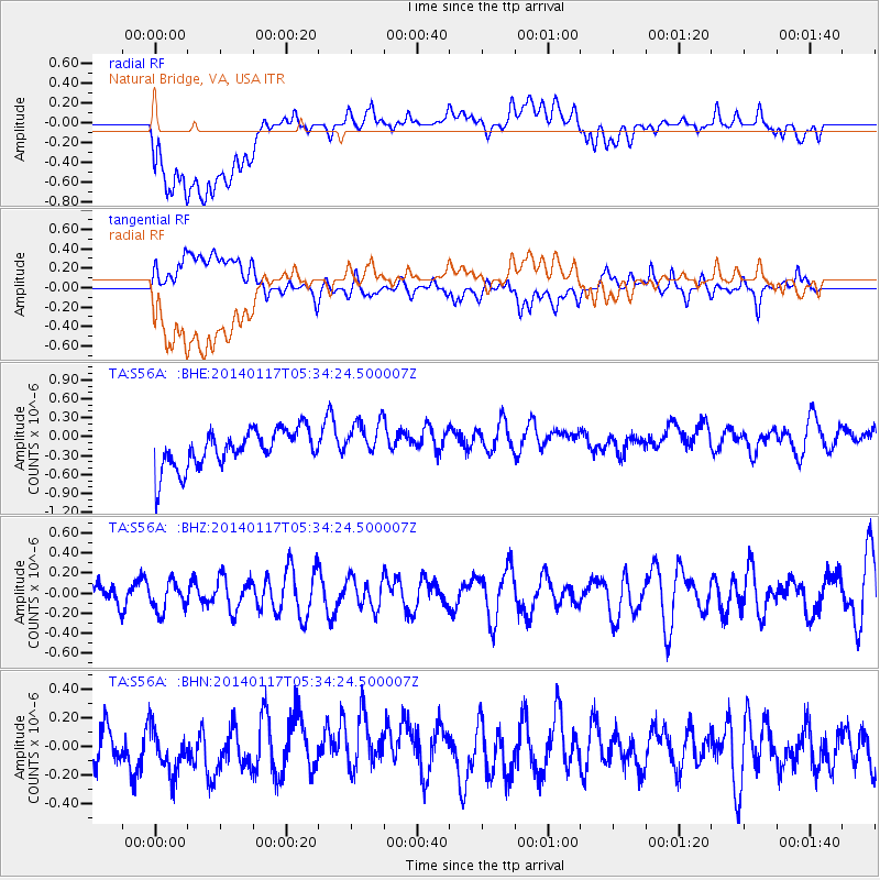
S56A Natural Bridge, VA, USA - Earthquake Result Viewer
*The percent match for this event was below the threshold and hence no stack was calculated.
| Earthquake location: |
Kuril Islands |
| Earthquake latitude/longitude: |
45.9/150.0 |
| Earthquake time(UTC): |
2014/01/17 (017) 05:22:39 GMT |
| Earthquake Depth: |
200 km |
| Earthquake Magnitude: |
3.7 mb |
| Earthquake Catalog/Contributor: |
ISC/ISC |
|
| Network: |
TA USArray Transportable Network (new EarthScope stations) |
| Station: |
S56A Natural Bridge, VA, USA |
| Lat/Lon: |
37.68 N/79.57 W |
| Elevation: |
449 m |
|
| Distance: |
85.6 deg |
| Az: |
37.304 deg |
| Baz: |
327.766 deg |
| Ray Param: |
$rayparam |
*The percent match for this event was below the threshold and hence was not used in the summary stack. |
|
| Radial Match: |
50.427067 % |
| Radial Bump: |
400 |
| Transverse Match: |
52.570957 % |
| Transverse Bump: |
400 |
| SOD ConfigId: |
3390531 |
| Insert Time: |
2019-04-10 00:42:03.230 +0000 |
| GWidth: |
2.5 |
| Max Bumps: |
400 |
| Tol: |
0.001 |
|
Signal To Noise
| Channel | StoN | STA | LTA |
| TA:S56A: :BHZ:20140117T05:34:24.500007Z | 0.9732469 | 1.4700518E-7 | 1.5104615E-7 |
| TA:S56A: :BHN:20140117T05:34:24.500007Z | 1.0665693 | 2.1673597E-7 | 2.0320851E-7 |
| TA:S56A: :BHE:20140117T05:34:24.500007Z | 1.0989795 | 3.243373E-7 | 2.9512591E-7 |
| Arrivals |
| Ps | |
| PpPs | |
| PsPs/PpSs | |


