You are here: Home > Network List > TA - USArray Transportable Network (new EarthScope stations) Stations List
> Station Y56A Pelion, SC, USA > Earthquake Result Viewer
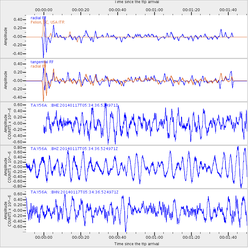
Y56A Pelion, SC, USA - Earthquake Result Viewer
*The percent match for this event was below the threshold and hence no stack was calculated.
| Earthquake location: |
Kuril Islands |
| Earthquake latitude/longitude: |
45.9/150.0 |
| Earthquake time(UTC): |
2014/01/17 (017) 05:22:39 GMT |
| Earthquake Depth: |
200 km |
| Earthquake Magnitude: |
3.7 mb |
| Earthquake Catalog/Contributor: |
ISC/ISC |
|
| Network: |
TA USArray Transportable Network (new EarthScope stations) |
| Station: |
Y56A Pelion, SC, USA |
| Lat/Lon: |
33.79 N/81.30 W |
| Elevation: |
154 m |
|
| Distance: |
88.1 deg |
| Az: |
40.591 deg |
| Baz: |
326.934 deg |
| Ray Param: |
$rayparam |
*The percent match for this event was below the threshold and hence was not used in the summary stack. |
|
| Radial Match: |
49.011776 % |
| Radial Bump: |
400 |
| Transverse Match: |
59.465534 % |
| Transverse Bump: |
400 |
| SOD ConfigId: |
3390531 |
| Insert Time: |
2019-04-10 00:42:20.668 +0000 |
| GWidth: |
2.5 |
| Max Bumps: |
400 |
| Tol: |
0.001 |
|
Signal To Noise
| Channel | StoN | STA | LTA |
| TA:Y56A: :BHZ:20140117T05:34:36.524971Z | 1.4427439 | 3.1001957E-7 | 2.1488192E-7 |
| TA:Y56A: :BHN:20140117T05:34:36.524971Z | 0.72586536 | 1.8747214E-7 | 2.5827399E-7 |
| TA:Y56A: :BHE:20140117T05:34:36.524971Z | 1.8016587 | 3.1419196E-7 | 1.7439038E-7 |
| Arrivals |
| Ps | |
| PpPs | |
| PsPs/PpSs | |


