You are here: Home > Network List > UU - University of Utah Regional Network Stations List
> Station KNB Kanab, UT, USA > Earthquake Result Viewer
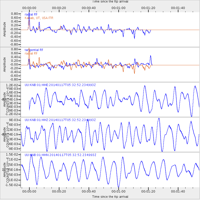
KNB Kanab, UT, USA - Earthquake Result Viewer
*The percent match for this event was below the threshold and hence no stack was calculated.
| Earthquake location: |
Kuril Islands |
| Earthquake latitude/longitude: |
45.9/150.0 |
| Earthquake time(UTC): |
2014/01/17 (017) 05:22:39 GMT |
| Earthquake Depth: |
200 km |
| Earthquake Magnitude: |
3.7 mb |
| Earthquake Catalog/Contributor: |
ISC/ISC |
|
| Network: |
UU University of Utah Regional Network |
| Station: |
KNB Kanab, UT, USA |
| Lat/Lon: |
37.02 N/112.82 W |
| Elevation: |
1715 m |
|
| Distance: |
68.9 deg |
| Az: |
58.334 deg |
| Baz: |
312.049 deg |
| Ray Param: |
$rayparam |
*The percent match for this event was below the threshold and hence was not used in the summary stack. |
|
| Radial Match: |
66.774216 % |
| Radial Bump: |
351 |
| Transverse Match: |
42.772953 % |
| Transverse Bump: |
390 |
| SOD ConfigId: |
3390531 |
| Insert Time: |
2019-04-10 00:42:43.117 +0000 |
| GWidth: |
2.5 |
| Max Bumps: |
400 |
| Tol: |
0.001 |
|
Signal To Noise
| Channel | StoN | STA | LTA |
| UU:KNB:01:HHZ:20140117T05:32:52.234993Z | 0.70562935 | 3.0035123E-9 | 4.2565014E-9 |
| UU:KNB:01:HHN:20140117T05:32:52.234993Z | 2.3241982 | 8.926564E-9 | 3.840707E-9 |
| UU:KNB:01:HHE:20140117T05:32:52.234993Z | 0.75318015 | 3.4782495E-9 | 4.618084E-9 |
| Arrivals |
| Ps | |
| PpPs | |
| PsPs/PpSs | |


