You are here: Home > Network List > TA - USArray Transportable Network (new EarthScope stations) Stations List
> Station O29A 4D Ranch, Culbertson, NE, USA > Earthquake Result Viewer
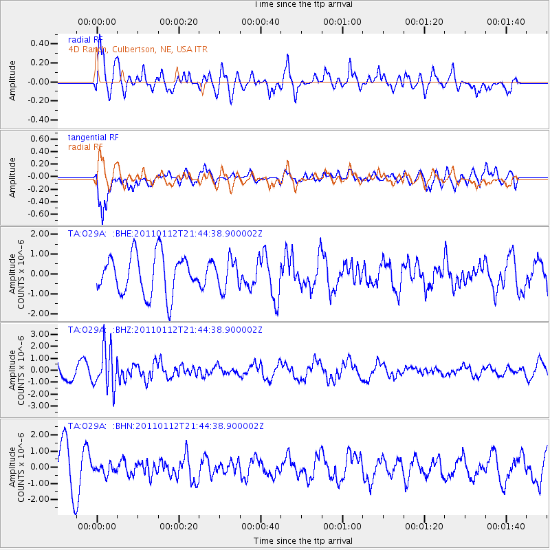
O29A 4D Ranch, Culbertson, NE, USA - Earthquake Result Viewer
*The percent match for this event was below the threshold and hence no stack was calculated.
| Earthquake location: |
Bonin Islands, Japan Region |
| Earthquake latitude/longitude: |
27.0/139.9 |
| Earthquake time(UTC): |
2011/01/12 (012) 21:32:55 GMT |
| Earthquake Depth: |
528 km |
| Earthquake Magnitude: |
6.2 MB, 6.5 MW, 6.5 MW |
| Earthquake Catalog/Contributor: |
WHDF/NEIC |
|
| Network: |
TA USArray Transportable Network (new EarthScope stations) |
| Station: |
O29A 4D Ranch, Culbertson, NE, USA |
| Lat/Lon: |
40.13 N/100.80 W |
| Elevation: |
826 m |
|
| Distance: |
92.6 deg |
| Az: |
42.001 deg |
| Baz: |
308.85 deg |
| Ray Param: |
$rayparam |
*The percent match for this event was below the threshold and hence was not used in the summary stack. |
|
| Radial Match: |
52.96306 % |
| Radial Bump: |
391 |
| Transverse Match: |
73.23573 % |
| Transverse Bump: |
400 |
| SOD ConfigId: |
346946 |
| Insert Time: |
2011-07-09 09:17:03.396 +0000 |
| GWidth: |
2.5 |
| Max Bumps: |
400 |
| Tol: |
0.001 |
|
Signal To Noise
| Channel | StoN | STA | LTA |
| TA:O29A: :BHZ:20110112T21:44:38.900002Z | 3.2009284 | 1.7048527E-6 | 5.326119E-7 |
| TA:O29A: :BHN:20110112T21:44:38.900002Z | 0.32548833 | 3.259532E-7 | 1.0014282E-6 |
| TA:O29A: :BHE:20110112T21:44:38.900002Z | 0.7522734 | 7.5214746E-7 | 9.998327E-7 |
| Arrivals |
| Ps | |
| PpPs | |
| PsPs/PpSs | |


