You are here: Home > Network List > TA - USArray Transportable Network (new EarthScope stations) Stations List
> Station J32A Parkston, SD, USA > Earthquake Result Viewer
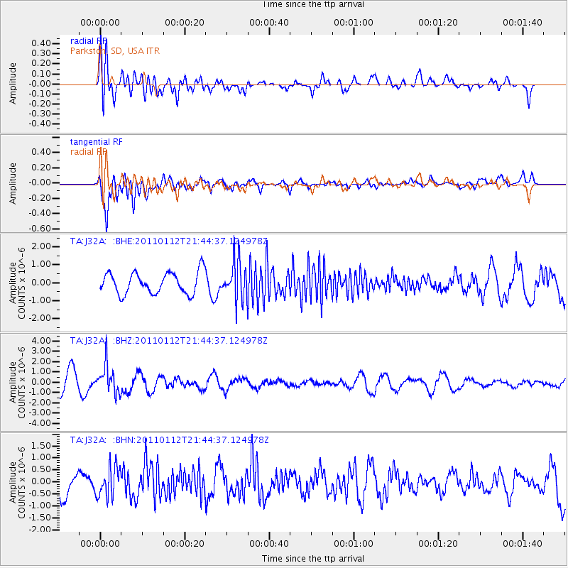
J32A Parkston, SD, USA - Earthquake Result Viewer
*The percent match for this event was below the threshold and hence no stack was calculated.
| Earthquake location: |
Bonin Islands, Japan Region |
| Earthquake latitude/longitude: |
27.0/139.9 |
| Earthquake time(UTC): |
2011/01/12 (012) 21:32:55 GMT |
| Earthquake Depth: |
528 km |
| Earthquake Magnitude: |
6.2 MB, 6.5 MW, 6.5 MW |
| Earthquake Catalog/Contributor: |
WHDF/NEIC |
|
| Network: |
TA USArray Transportable Network (new EarthScope stations) |
| Station: |
J32A Parkston, SD, USA |
| Lat/Lon: |
43.37 N/97.85 W |
| Elevation: |
399 m |
|
| Distance: |
92.2 deg |
| Az: |
38.094 deg |
| Baz: |
310.973 deg |
| Ray Param: |
$rayparam |
*The percent match for this event was below the threshold and hence was not used in the summary stack. |
|
| Radial Match: |
64.07258 % |
| Radial Bump: |
400 |
| Transverse Match: |
74.981186 % |
| Transverse Bump: |
400 |
| SOD ConfigId: |
346946 |
| Insert Time: |
2011-07-09 09:38:28.078 +0000 |
| GWidth: |
2.5 |
| Max Bumps: |
400 |
| Tol: |
0.001 |
|
Signal To Noise
| Channel | StoN | STA | LTA |
| TA:J32A: :BHZ:20110112T21:44:37.124978Z | 1.6127756 | 1.3824986E-6 | 8.5721695E-7 |
| TA:J32A: :BHN:20110112T21:44:37.124978Z | 1.4065549 | 6.289485E-7 | 4.4715532E-7 |
| TA:J32A: :BHE:20110112T21:44:37.124978Z | 1.8663622 | 1.1083927E-6 | 5.9387867E-7 |
| Arrivals |
| Ps | |
| PpPs | |
| PsPs/PpSs | |


