You are here: Home > Network List > TA - USArray Transportable Network (new EarthScope stations) Stations List
> Station E33A Westby DABS, Erhard, MN, USA > Earthquake Result Viewer
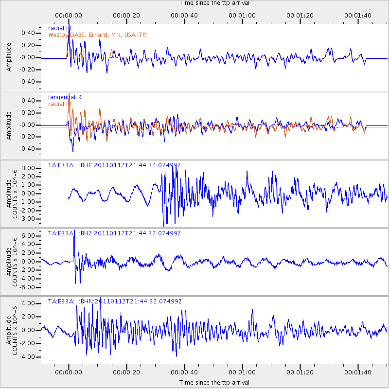
E33A Westby DABS, Erhard, MN, USA - Earthquake Result Viewer
*The percent match for this event was below the threshold and hence no stack was calculated.
| Earthquake location: |
Bonin Islands, Japan Region |
| Earthquake latitude/longitude: |
27.0/139.9 |
| Earthquake time(UTC): |
2011/01/12 (012) 21:32:55 GMT |
| Earthquake Depth: |
528 km |
| Earthquake Magnitude: |
6.2 MB, 6.5 MW, 6.5 MW |
| Earthquake Catalog/Contributor: |
WHDF/NEIC |
|
| Network: |
TA USArray Transportable Network (new EarthScope stations) |
| Station: |
E33A Westby DABS, Erhard, MN, USA |
| Lat/Lon: |
46.50 N/96.01 W |
| Elevation: |
428 m |
|
| Distance: |
91.1 deg |
| Az: |
34.884 deg |
| Baz: |
312.364 deg |
| Ray Param: |
$rayparam |
*The percent match for this event was below the threshold and hence was not used in the summary stack. |
|
| Radial Match: |
68.13594 % |
| Radial Bump: |
400 |
| Transverse Match: |
74.4107 % |
| Transverse Bump: |
400 |
| SOD ConfigId: |
346946 |
| Insert Time: |
2011-07-09 09:45:43.790 +0000 |
| GWidth: |
2.5 |
| Max Bumps: |
400 |
| Tol: |
0.001 |
|
Signal To Noise
| Channel | StoN | STA | LTA |
| TA:E33A: :BHZ:20110112T21:44:32.07499Z | 4.5138755 | 2.219619E-6 | 4.9173246E-7 |
| TA:E33A: :BHN:20110112T21:44:32.07499Z | 3.2266414 | 1.3183069E-6 | 4.0856938E-7 |
| TA:E33A: :BHE:20110112T21:44:32.07499Z | 3.1548047 | 1.6374759E-6 | 5.190419E-7 |
| Arrivals |
| Ps | |
| PpPs | |
| PsPs/PpSs | |


