You are here: Home > Network List > TA - USArray Transportable Network (new EarthScope stations) Stations List
> Station E36A McGregor, MN, USA > Earthquake Result Viewer
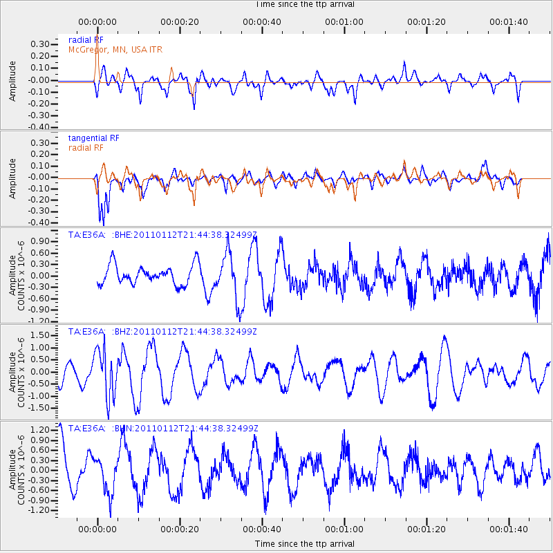
E36A McGregor, MN, USA - Earthquake Result Viewer
*The percent match for this event was below the threshold and hence no stack was calculated.
| Earthquake location: |
Bonin Islands, Japan Region |
| Earthquake latitude/longitude: |
27.0/139.9 |
| Earthquake time(UTC): |
2011/01/12 (012) 21:32:55 GMT |
| Earthquake Depth: |
528 km |
| Earthquake Magnitude: |
6.2 MB, 6.5 MW, 6.5 MW |
| Earthquake Catalog/Contributor: |
WHDF/NEIC |
|
| Network: |
TA USArray Transportable Network (new EarthScope stations) |
| Station: |
E36A McGregor, MN, USA |
| Lat/Lon: |
46.52 N/93.26 W |
| Elevation: |
393 m |
|
| Distance: |
92.5 deg |
| Az: |
33.568 deg |
| Baz: |
314.394 deg |
| Ray Param: |
$rayparam |
*The percent match for this event was below the threshold and hence was not used in the summary stack. |
|
| Radial Match: |
45.404648 % |
| Radial Bump: |
389 |
| Transverse Match: |
61.88992 % |
| Transverse Bump: |
399 |
| SOD ConfigId: |
346946 |
| Insert Time: |
2011-07-09 09:54:42.769 +0000 |
| GWidth: |
2.5 |
| Max Bumps: |
400 |
| Tol: |
0.001 |
|
Signal To Noise
| Channel | StoN | STA | LTA |
| TA:E36A: :BHZ:20110112T21:44:38.32499Z | 2.2598424 | 9.820837E-7 | 4.3458067E-7 |
| TA:E36A: :BHN:20110112T21:44:38.32499Z | 0.68836427 | 5.3562337E-7 | 7.7811035E-7 |
| TA:E36A: :BHE:20110112T21:44:38.32499Z | 2.5425658 | 6.3740606E-7 | 2.50694E-7 |
| Arrivals |
| Ps | |
| PpPs | |
| PsPs/PpSs | |


