You are here: Home > Network List > US - United States National Seismic Network Stations List
> Station NEW Newport, Washington, USA > Earthquake Result Viewer
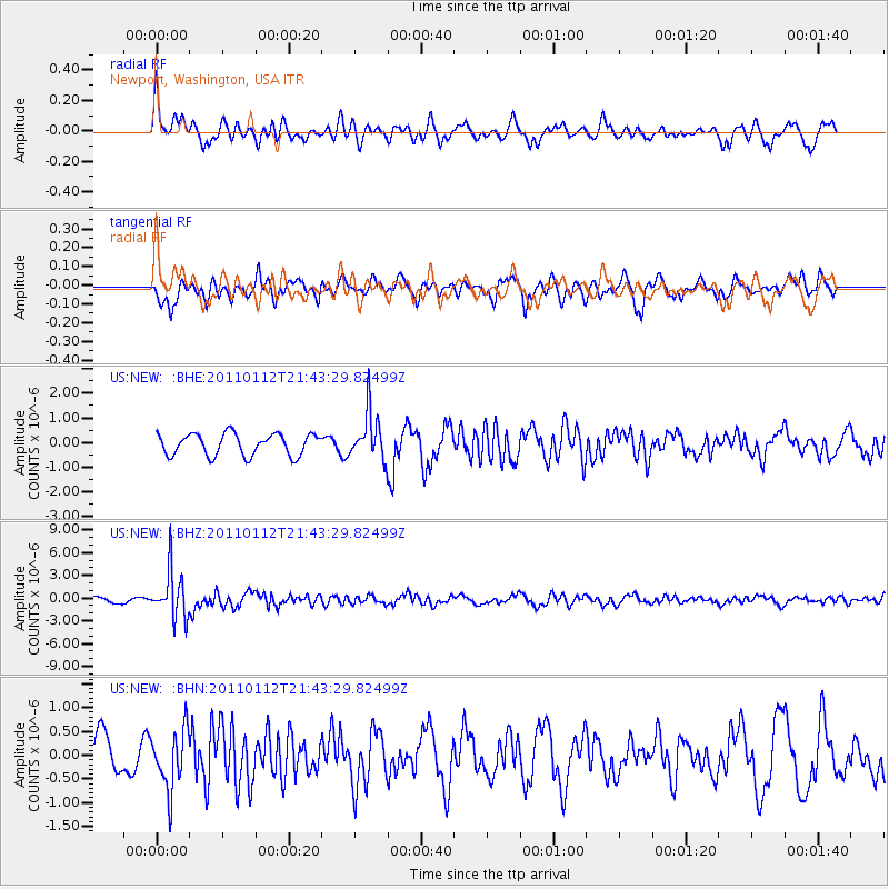
NEW Newport, Washington, USA - Earthquake Result Viewer
*The percent match for this event was below the threshold and hence no stack was calculated.
| Earthquake location: |
Bonin Islands, Japan Region |
| Earthquake latitude/longitude: |
27.0/139.9 |
| Earthquake time(UTC): |
2011/01/12 (012) 21:32:55 GMT |
| Earthquake Depth: |
528 km |
| Earthquake Magnitude: |
6.2 MB, 6.5 MW, 6.5 MW |
| Earthquake Catalog/Contributor: |
WHDF/NEIC |
|
| Network: |
US United States National Seismic Network |
| Station: |
NEW Newport, Washington, USA |
| Lat/Lon: |
48.26 N/117.12 W |
| Elevation: |
760 m |
|
| Distance: |
78.4 deg |
| Az: |
41.657 deg |
| Baz: |
297.415 deg |
| Ray Param: |
$rayparam |
*The percent match for this event was below the threshold and hence was not used in the summary stack. |
|
| Radial Match: |
66.549995 % |
| Radial Bump: |
400 |
| Transverse Match: |
60.675514 % |
| Transverse Bump: |
400 |
| SOD ConfigId: |
346946 |
| Insert Time: |
2011-07-09 09:57:19.685 +0000 |
| GWidth: |
2.5 |
| Max Bumps: |
400 |
| Tol: |
0.001 |
|
Signal To Noise
| Channel | StoN | STA | LTA |
| US:NEW: :BHZ:20110112T21:43:29.82499Z | 10.653176 | 3.0724475E-6 | 2.884067E-7 |
| US:NEW: :BHN:20110112T21:43:29.82499Z | 2.1517167 | 6.244358E-7 | 2.9020353E-7 |
| US:NEW: :BHE:20110112T21:43:29.82499Z | 2.167441 | 9.4839976E-7 | 4.375666E-7 |
| Arrivals |
| Ps | |
| PpPs | |
| PsPs/PpSs | |


