You are here: Home > Network List > US - United States National Seismic Network Stations List
> Station BOZ Bozeman, Montana, USA > Earthquake Result Viewer
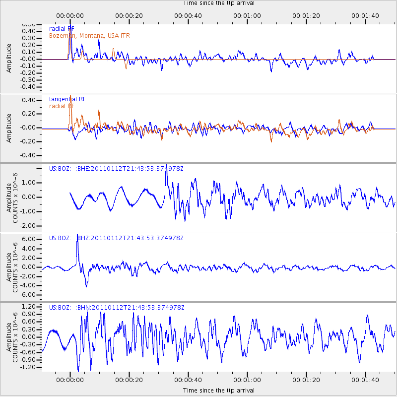
BOZ Bozeman, Montana, USA - Earthquake Result Viewer
*The percent match for this event was below the threshold and hence no stack was calculated.
| Earthquake location: |
Bonin Islands, Japan Region |
| Earthquake latitude/longitude: |
27.0/139.9 |
| Earthquake time(UTC): |
2011/01/12 (012) 21:32:55 GMT |
| Earthquake Depth: |
528 km |
| Earthquake Magnitude: |
6.2 MB, 6.5 MW, 6.5 MW |
| Earthquake Catalog/Contributor: |
WHDF/NEIC |
|
| Network: |
US United States National Seismic Network |
| Station: |
BOZ Bozeman, Montana, USA |
| Lat/Lon: |
45.65 N/111.63 W |
| Elevation: |
1589 m |
|
| Distance: |
82.9 deg |
| Az: |
42.091 deg |
| Baz: |
301.488 deg |
| Ray Param: |
$rayparam |
*The percent match for this event was below the threshold and hence was not used in the summary stack. |
|
| Radial Match: |
70.12887 % |
| Radial Bump: |
400 |
| Transverse Match: |
56.66634 % |
| Transverse Bump: |
400 |
| SOD ConfigId: |
346946 |
| Insert Time: |
2011-07-09 09:59:52.382 +0000 |
| GWidth: |
2.5 |
| Max Bumps: |
400 |
| Tol: |
0.001 |
|
Signal To Noise
| Channel | StoN | STA | LTA |
| US:BOZ: :BHZ:20110112T21:43:53.374978Z | 8.930947 | 2.026463E-6 | 2.2690348E-7 |
| US:BOZ: :BHN:20110112T21:43:53.374978Z | 1.7590883 | 5.663371E-7 | 3.2194924E-7 |
| US:BOZ: :BHE:20110112T21:43:53.374978Z | 2.1065497 | 8.552687E-7 | 4.0600452E-7 |
| Arrivals |
| Ps | |
| PpPs | |
| PsPs/PpSs | |


