You are here: Home > Network List > US - United States National Seismic Network Stations List
> Station DGMT Dagmar, Montana, USA > Earthquake Result Viewer
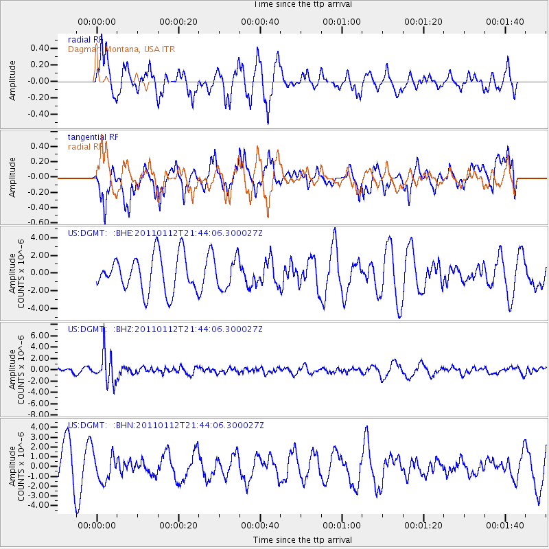
DGMT Dagmar, Montana, USA - Earthquake Result Viewer
*The percent match for this event was below the threshold and hence no stack was calculated.
| Earthquake location: |
Bonin Islands, Japan Region |
| Earthquake latitude/longitude: |
27.0/139.9 |
| Earthquake time(UTC): |
2011/01/12 (012) 21:32:55 GMT |
| Earthquake Depth: |
528 km |
| Earthquake Magnitude: |
6.2 MB, 6.5 MW, 6.5 MW |
| Earthquake Catalog/Contributor: |
WHDF/NEIC |
|
| Network: |
US United States National Seismic Network |
| Station: |
DGMT Dagmar, Montana, USA |
| Lat/Lon: |
48.47 N/104.20 W |
| Elevation: |
0.0 m |
|
| Distance: |
85.6 deg |
| Az: |
36.889 deg |
| Baz: |
306.397 deg |
| Ray Param: |
$rayparam |
*The percent match for this event was below the threshold and hence was not used in the summary stack. |
|
| Radial Match: |
53.528767 % |
| Radial Bump: |
265 |
| Transverse Match: |
57.827618 % |
| Transverse Bump: |
342 |
| SOD ConfigId: |
346946 |
| Insert Time: |
2011-07-09 10:00:34.618 +0000 |
| GWidth: |
2.5 |
| Max Bumps: |
400 |
| Tol: |
0.001 |
|
Signal To Noise
| Channel | StoN | STA | LTA |
| US:DGMT: :BHZ:20110112T21:44:06.300027Z | 4.426945 | 2.7016783E-6 | 6.102805E-7 |
| US:DGMT: :BHN:20110112T21:44:06.300027Z | 0.80588746 | 1.3570545E-6 | 1.6839257E-6 |
| US:DGMT: :BHE:20110112T21:44:06.300027Z | 0.82917446 | 1.7051862E-6 | 2.0564867E-6 |
| Arrivals |
| Ps | |
| PpPs | |
| PsPs/PpSs | |


