You are here: Home > Network List > UW - Pacific Northwest Regional Seismic Network Stations List
> Station MRBL Marblemount, WA, USA > Earthquake Result Viewer
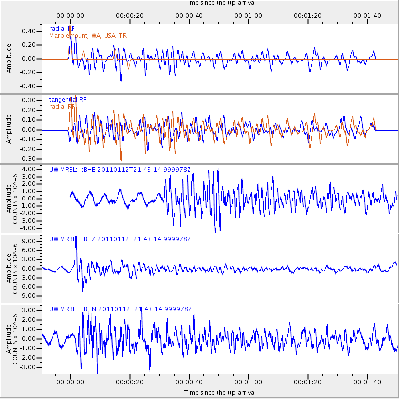
MRBL Marblemount, WA, USA - Earthquake Result Viewer
*The percent match for this event was below the threshold and hence no stack was calculated.
| Earthquake location: |
Bonin Islands, Japan Region |
| Earthquake latitude/longitude: |
27.0/139.9 |
| Earthquake time(UTC): |
2011/01/12 (012) 21:32:55 GMT |
| Earthquake Depth: |
528 km |
| Earthquake Magnitude: |
6.2 MB, 6.5 MW, 6.5 MW |
| Earthquake Catalog/Contributor: |
WHDF/NEIC |
|
| Network: |
UW Pacific Northwest Regional Seismic Network |
| Station: |
MRBL Marblemount, WA, USA |
| Lat/Lon: |
48.52 N/121.48 W |
| Elevation: |
75 m |
|
| Distance: |
75.6 deg |
| Az: |
42.726 deg |
| Baz: |
294.401 deg |
| Ray Param: |
$rayparam |
*The percent match for this event was below the threshold and hence was not used in the summary stack. |
|
| Radial Match: |
65.37352 % |
| Radial Bump: |
400 |
| Transverse Match: |
71.02378 % |
| Transverse Bump: |
400 |
| SOD ConfigId: |
346946 |
| Insert Time: |
2011-07-09 10:04:39.673 +0000 |
| GWidth: |
2.5 |
| Max Bumps: |
400 |
| Tol: |
0.001 |
|
Signal To Noise
| Channel | StoN | STA | LTA |
| UW:MRBL: :BHZ:20110112T21:43:14.999978Z | 9.850036 | 3.837968E-6 | 3.8963998E-7 |
| UW:MRBL: :BHN:20110112T21:43:14.999978Z | 2.0438364 | 1.1679502E-6 | 5.7145E-7 |
| UW:MRBL: :BHE:20110112T21:43:14.999978Z | 2.3881016 | 1.5100461E-6 | 6.3232073E-7 |
| Arrivals |
| Ps | |
| PpPs | |
| PsPs/PpSs | |


