You are here: Home > Network List > UW - Pacific Northwest Regional Seismic Network Stations List
> Station LEBA Lebam, WA, USA > Earthquake Result Viewer
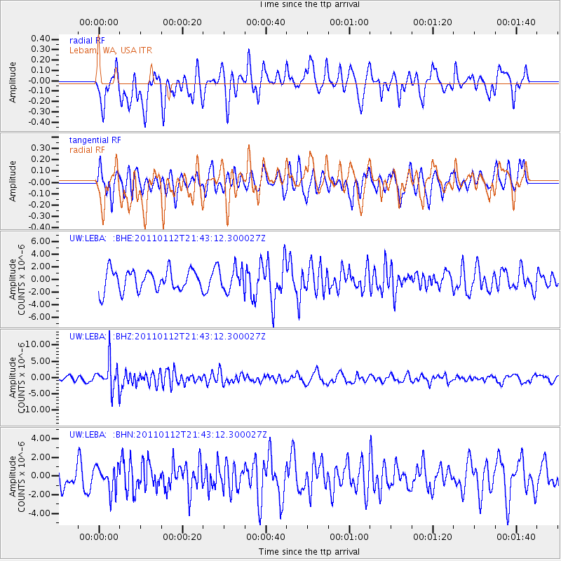
LEBA Lebam, WA, USA - Earthquake Result Viewer
*The percent match for this event was below the threshold and hence no stack was calculated.
| Earthquake location: |
Bonin Islands, Japan Region |
| Earthquake latitude/longitude: |
27.0/139.9 |
| Earthquake time(UTC): |
2011/01/12 (012) 21:32:55 GMT |
| Earthquake Depth: |
528 km |
| Earthquake Magnitude: |
6.2 MB, 6.5 MW, 6.5 MW |
| Earthquake Catalog/Contributor: |
WHDF/NEIC |
|
| Network: |
UW Pacific Northwest Regional Seismic Network |
| Station: |
LEBA Lebam, WA, USA |
| Lat/Lon: |
46.55 N/123.56 W |
| Elevation: |
73 m |
|
| Distance: |
75.2 deg |
| Az: |
45.18 deg |
| Baz: |
293.49 deg |
| Ray Param: |
$rayparam |
*The percent match for this event was below the threshold and hence was not used in the summary stack. |
|
| Radial Match: |
60.300865 % |
| Radial Bump: |
379 |
| Transverse Match: |
49.19491 % |
| Transverse Bump: |
400 |
| SOD ConfigId: |
346946 |
| Insert Time: |
2011-07-09 10:05:42.562 +0000 |
| GWidth: |
2.5 |
| Max Bumps: |
400 |
| Tol: |
0.001 |
|
Signal To Noise
| Channel | StoN | STA | LTA |
| UW:LEBA: :BHZ:20110112T21:43:12.300027Z | 5.50662 | 4.3866326E-6 | 7.966107E-7 |
| UW:LEBA: :BHN:20110112T21:43:12.300027Z | 0.8906807 | 1.3263098E-6 | 1.4890968E-6 |
| UW:LEBA: :BHE:20110112T21:43:12.300027Z | 1.0509734 | 1.7324626E-6 | 1.6484363E-6 |
| Arrivals |
| Ps | |
| PpPs | |
| PsPs/PpSs | |


