You are here: Home > Network List > TA - USArray Transportable Network (new EarthScope stations) Stations List
> Station I48A Sherman Twp, MI, USA > Earthquake Result Viewer
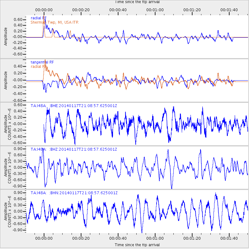
I48A Sherman Twp, MI, USA - Earthquake Result Viewer
*The percent match for this event was below the threshold and hence no stack was calculated.
| Earthquake location: |
Costa Rica |
| Earthquake latitude/longitude: |
9.6/-84.8 |
| Earthquake time(UTC): |
2014/01/17 (017) 21:02:42 GMT |
| Earthquake Depth: |
27 km |
| Earthquake Magnitude: |
5.3 MW |
| Earthquake Catalog/Contributor: |
ISC/ISC |
|
| Network: |
TA USArray Transportable Network (new EarthScope stations) |
| Station: |
I48A Sherman Twp, MI, USA |
| Lat/Lon: |
44.19 N/83.70 W |
| Elevation: |
192 m |
|
| Distance: |
34.5 deg |
| Az: |
1.406 deg |
| Baz: |
181.928 deg |
| Ray Param: |
$rayparam |
*The percent match for this event was below the threshold and hence was not used in the summary stack. |
|
| Radial Match: |
63.49469 % |
| Radial Bump: |
400 |
| Transverse Match: |
57.742706 % |
| Transverse Bump: |
400 |
| SOD ConfigId: |
3390531 |
| Insert Time: |
2019-04-10 00:48:20.521 +0000 |
| GWidth: |
2.5 |
| Max Bumps: |
400 |
| Tol: |
0.001 |
|
Signal To Noise
| Channel | StoN | STA | LTA |
| TA:I48A: :BHZ:20140117T21:08:57.625001Z | 2.260335 | 5.2608027E-7 | 2.3274438E-7 |
| TA:I48A: :BHN:20140117T21:08:57.625001Z | 1.4619187 | 3.0281598E-7 | 2.0713598E-7 |
| TA:I48A: :BHE:20140117T21:08:57.625001Z | 0.5752471 | 1.5635814E-7 | 2.718104E-7 |
| Arrivals |
| Ps | |
| PpPs | |
| PsPs/PpSs | |


