MUR Murrieta - Earthquake Result Viewer
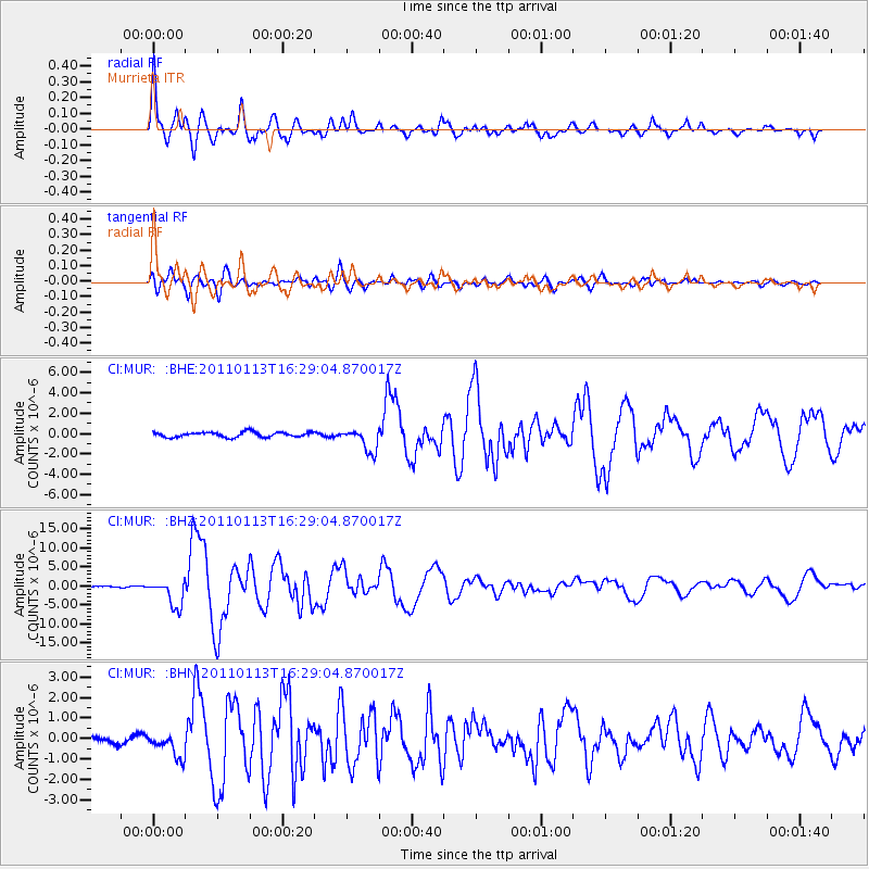
Earthquake location: Loyalty Islands
Earthquake latitude/longitude: -20.6/168.5
Earthquake time(UTC): 2011/01/13 (013) 16:16:41 GMT
Earthquake Depth: 9.0 km
Earthquake Magnitude: 6.6 MB, 7.1 MS, 7.0 MW, 6.9 MW
Earthquake Catalog/Contributor: WHDF/NEIC
Network: CI Caltech Regional Seismic Network
Station: MUR Murrieta
Lat/Lon: 33.60 N/117.20 W
Elevation: 562 m
Distance: 89.0 deg
Az: 53.49 deg
Baz: 244.424 deg
Ray Param: 0.04220202
Estimated Moho Depth: 12.75 km
Estimated Crust Vp/Vs: 1.61
Assumed Crust Vp: 6.264 km/s
Estimated Crust Vs: 3.884 km/s
Estimated Crust Poisson's Ratio: 0.19
Radial Match: 96.723366 %
Radial Bump: 400
Transverse Match: 86.87002 %
Transverse Bump: 400
SOD ConfigId: 346946
Insert Time: 2011-07-09 10:46:06.844 +0000
GWidth: 2.5
Max Bumps: 400
Tol: 0.001

Signal To Noise

ChannelStoNSTALTA
CI:MUR: :BHZ:20110113T16:29:04.870017Z16.6796323.6076674E-62.1629178E-7
CI:MUR: :BHN:20110113T16:29:04.870017Z2.0263336.072367E-72.9967268E-7
CI:MUR: :BHE:20110113T16:29:04.870017Z4.7372041.1666513E-62.462742E-7
Arrivals
Ps1.3 SECOND
PpPs5.2 SECOND
PsPs/PpSs6.5 SECOND