You are here: Home > Network List > AZ - ANZA Regional Network Stations List
> Station FRD AZ.FRD > Earthquake Result Viewer
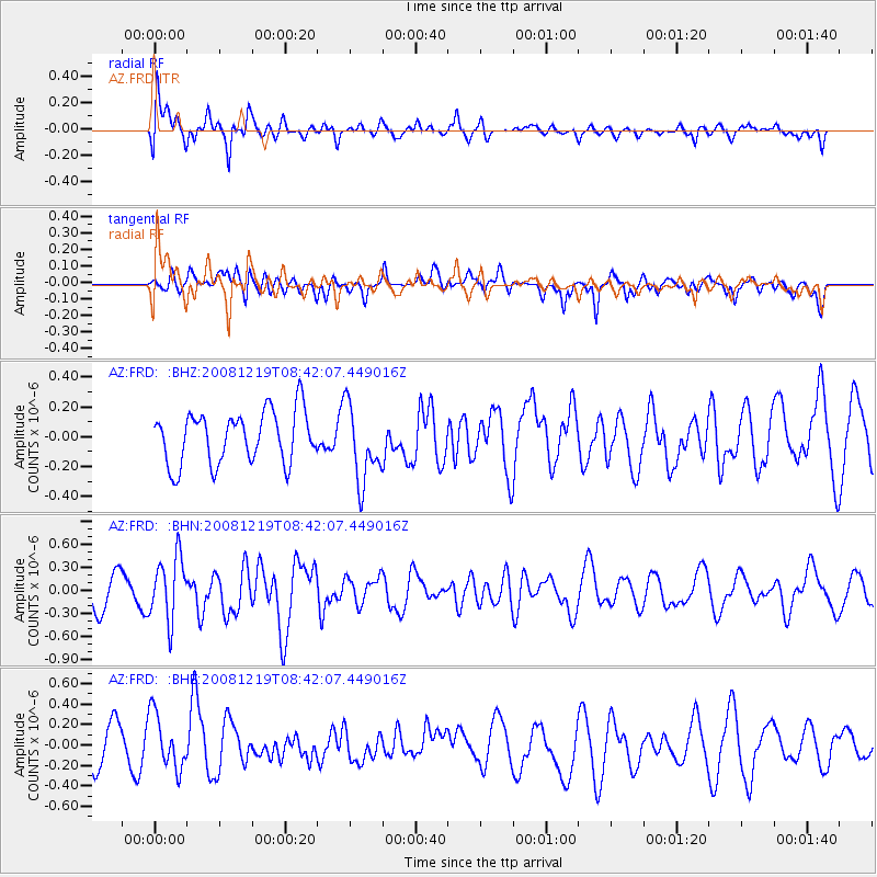
FRD AZ.FRD - Earthquake Result Viewer
*The percent match for this event was below the threshold and hence no stack was calculated.
| Earthquake location: |
Northern Mid-Atlantic Ridge |
| Earthquake latitude/longitude: |
47.0/-27.3 |
| Earthquake time(UTC): |
2008/12/19 (354) 08:31:51 GMT |
| Earthquake Depth: |
2.0 km |
| Earthquake Magnitude: |
5.8 MB, 5.6 MS, 5.9 MW, 5.8 MW |
| Earthquake Catalog/Contributor: |
WHDF/NEIC |
|
| Network: |
AZ ANZA Regional Network |
| Station: |
FRD AZ.FRD |
| Lat/Lon: |
33.49 N/116.60 W |
| Elevation: |
1164 m |
|
| Distance: |
66.0 deg |
| Az: |
293.806 deg |
| Baz: |
48.535 deg |
| Ray Param: |
$rayparam |
*The percent match for this event was below the threshold and hence was not used in the summary stack. |
|
| Radial Match: |
61.86236 % |
| Radial Bump: |
400 |
| Transverse Match: |
57.813362 % |
| Transverse Bump: |
400 |
| SOD ConfigId: |
2658 |
| Insert Time: |
2010-02-26 19:22:21.359 +0000 |
| GWidth: |
2.5 |
| Max Bumps: |
400 |
| Tol: |
0.001 |
|
Signal To Noise
| Channel | StoN | STA | LTA |
| AZ:FRD: :BHN:20081219T08:42:07.449016Z | 2.077199 | 4.1023955E-7 | 1.974965E-7 |
| AZ:FRD: :BHE:20081219T08:42:07.449016Z | 1.7547237 | 2.7323367E-7 | 1.5571321E-7 |
| AZ:FRD: :BHZ:20081219T08:42:07.449016Z | 1.4751594 | 2.567862E-7 | 1.7407352E-7 |
| Arrivals |
| Ps | |
| PpPs | |
| PsPs/PpSs | |


