You are here: Home > Network List > TA - USArray Transportable Network (new EarthScope stations) Stations List
> Station M04C Macdoel, CA, USA > Earthquake Result Viewer
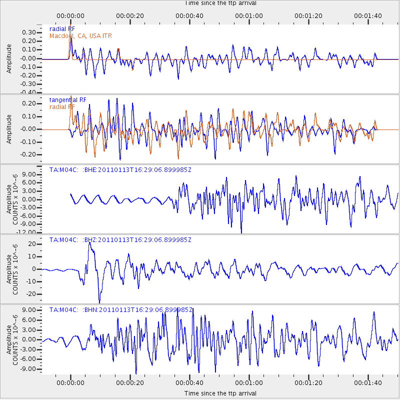
M04C Macdoel, CA, USA - Earthquake Result Viewer
*The percent match for this event was below the threshold and hence no stack was calculated.
| Earthquake location: |
Loyalty Islands |
| Earthquake latitude/longitude: |
-20.6/168.5 |
| Earthquake time(UTC): |
2011/01/13 (013) 16:16:41 GMT |
| Earthquake Depth: |
9.0 km |
| Earthquake Magnitude: |
6.6 MB, 7.1 MS, 7.0 MW, 6.9 MW |
| Earthquake Catalog/Contributor: |
WHDF/NEIC |
|
| Network: |
TA USArray Transportable Network (new EarthScope stations) |
| Station: |
M04C Macdoel, CA, USA |
| Lat/Lon: |
41.78 N/121.84 W |
| Elevation: |
1391 m |
|
| Distance: |
89.4 deg |
| Az: |
44.542 deg |
| Baz: |
241.459 deg |
| Ray Param: |
$rayparam |
*The percent match for this event was below the threshold and hence was not used in the summary stack. |
|
| Radial Match: |
76.54636 % |
| Radial Bump: |
400 |
| Transverse Match: |
75.99688 % |
| Transverse Bump: |
400 |
| SOD ConfigId: |
346946 |
| Insert Time: |
2011-07-09 11:06:01.834 +0000 |
| GWidth: |
2.5 |
| Max Bumps: |
400 |
| Tol: |
0.001 |
|
Signal To Noise
| Channel | StoN | STA | LTA |
| TA:M04C: :BHZ:20110113T16:29:06.899985Z | 9.623936 | 4.8231404E-6 | 5.011609E-7 |
| TA:M04C: :BHN:20110113T16:29:06.899985Z | 2.3317819 | 1.5202226E-6 | 6.5195746E-7 |
| TA:M04C: :BHE:20110113T16:29:06.899985Z | 1.1758807 | 1.0906114E-6 | 9.2748473E-7 |
| Arrivals |
| Ps | |
| PpPs | |
| PsPs/PpSs | |


