You are here: Home > Network List > TA - USArray Transportable Network (new EarthScope stations) Stations List
> Station G05D Wamic, OR, USA > Earthquake Result Viewer
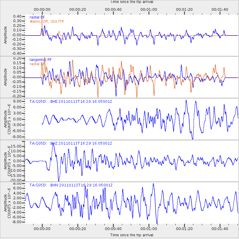
G05D Wamic, OR, USA - Earthquake Result Viewer
*The percent match for this event was below the threshold and hence no stack was calculated.
| Earthquake location: |
Loyalty Islands |
| Earthquake latitude/longitude: |
-20.6/168.5 |
| Earthquake time(UTC): |
2011/01/13 (013) 16:16:41 GMT |
| Earthquake Depth: |
9.0 km |
| Earthquake Magnitude: |
6.6 MB, 7.1 MS, 7.0 MW, 6.9 MW |
| Earthquake Catalog/Contributor: |
WHDF/NEIC |
|
| Network: |
TA USArray Transportable Network (new EarthScope stations) |
| Station: |
G05D Wamic, OR, USA |
| Lat/Lon: |
45.24 N/121.32 W |
| Elevation: |
592 m |
|
| Distance: |
91.4 deg |
| Az: |
41.68 deg |
| Baz: |
241.837 deg |
| Ray Param: |
$rayparam |
*The percent match for this event was below the threshold and hence was not used in the summary stack. |
|
| Radial Match: |
76.628265 % |
| Radial Bump: |
400 |
| Transverse Match: |
74.87406 % |
| Transverse Bump: |
400 |
| SOD ConfigId: |
346946 |
| Insert Time: |
2011-07-09 11:13:16.916 +0000 |
| GWidth: |
2.5 |
| Max Bumps: |
400 |
| Tol: |
0.001 |
|
Signal To Noise
| Channel | StoN | STA | LTA |
| TA:G05D: :BHZ:20110113T16:29:16.05001Z | 4.1742516 | 4.5115103E-6 | 1.0807951E-6 |
| TA:G05D: :BHN:20110113T16:29:16.05001Z | 1.0714295 | 1.7972751E-6 | 1.6774553E-6 |
| TA:G05D: :BHE:20110113T16:29:16.05001Z | 1.6526163 | 1.946063E-6 | 1.177565E-6 |
| Arrivals |
| Ps | |
| PpPs | |
| PsPs/PpSs | |


