You are here: Home > Network List > US - United States National Seismic Network Stations List
> Station BOZ Bozeman, Montana, USA > Earthquake Result Viewer
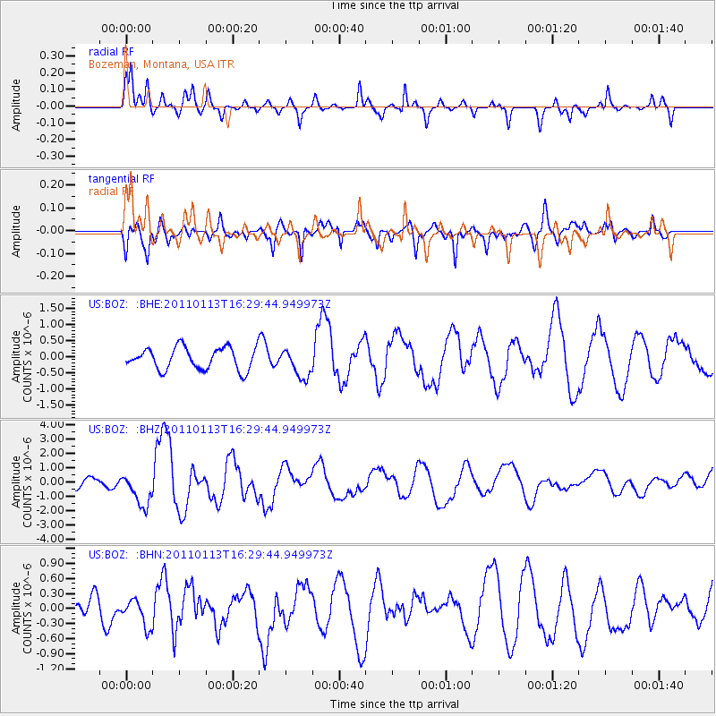
BOZ Bozeman, Montana, USA - Earthquake Result Viewer
*The percent match for this event was below the threshold and hence no stack was calculated.
| Earthquake location: |
Loyalty Islands |
| Earthquake latitude/longitude: |
-20.6/168.5 |
| Earthquake time(UTC): |
2011/01/13 (013) 16:16:41 GMT |
| Earthquake Depth: |
9.0 km |
| Earthquake Magnitude: |
6.6 MB, 7.1 MS, 7.0 MW, 6.9 MW |
| Earthquake Catalog/Contributor: |
WHDF/NEIC |
|
| Network: |
US United States National Seismic Network |
| Station: |
BOZ Bozeman, Montana, USA |
| Lat/Lon: |
45.65 N/111.63 W |
| Elevation: |
1589 m |
|
| Distance: |
97.7 deg |
| Az: |
44.181 deg |
| Baz: |
248.526 deg |
| Ray Param: |
$rayparam |
*The percent match for this event was below the threshold and hence was not used in the summary stack. |
|
| Radial Match: |
65.0791 % |
| Radial Bump: |
328 |
| Transverse Match: |
76.00144 % |
| Transverse Bump: |
400 |
| SOD ConfigId: |
346946 |
| Insert Time: |
2011-07-09 11:35:40.429 +0000 |
| GWidth: |
2.5 |
| Max Bumps: |
400 |
| Tol: |
0.001 |
|
Signal To Noise
| Channel | StoN | STA | LTA |
| US:BOZ: :BHZ:20110113T16:29:44.949973Z | 2.9284909 | 1.157825E-6 | 3.9536573E-7 |
| US:BOZ: :BHN:20110113T16:29:44.949973Z | 1.0969696 | 2.763478E-7 | 2.519193E-7 |
| US:BOZ: :BHE:20110113T16:29:44.949973Z | 1.3337268 | 4.5749113E-7 | 3.4301715E-7 |
| Arrivals |
| Ps | |
| PpPs | |
| PsPs/PpSs | |


