You are here: Home > Network List > CI - Caltech Regional Seismic Network Stations List
> Station GLA Glamis, Glamis, CA, USA > Earthquake Result Viewer
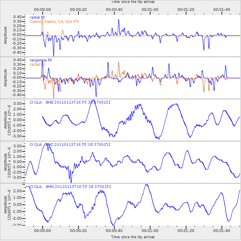
GLA Glamis, Glamis, CA, USA - Earthquake Result Viewer
*The percent match for this event was below the threshold and hence no stack was calculated.
| Earthquake location: |
Loyalty Islands |
| Earthquake latitude/longitude: |
-20.6/168.4 |
| Earthquake time(UTC): |
2011/01/13 (013) 16:43:07 GMT |
| Earthquake Depth: |
10 km |
| Earthquake Magnitude: |
5.9 MB, 5.9 MW |
| Earthquake Catalog/Contributor: |
WHDF/NEIC |
|
| Network: |
CI Caltech Regional Seismic Network |
| Station: |
GLA Glamis, Glamis, CA, USA |
| Lat/Lon: |
33.05 N/114.83 W |
| Elevation: |
610 m |
|
| Distance: |
90.6 deg |
| Az: |
54.846 deg |
| Baz: |
245.782 deg |
| Ray Param: |
$rayparam |
*The percent match for this event was below the threshold and hence was not used in the summary stack. |
|
| Radial Match: |
68.04645 % |
| Radial Bump: |
314 |
| Transverse Match: |
61.19284 % |
| Transverse Bump: |
349 |
| SOD ConfigId: |
346946 |
| Insert Time: |
2011-07-09 12:03:31.868 +0000 |
| GWidth: |
2.5 |
| Max Bumps: |
400 |
| Tol: |
0.001 |
|
Signal To Noise
| Channel | StoN | STA | LTA |
| CI:GLA: :BHZ:20110113T16:55:38.370015Z | 2.796192 | 3.1007992E-6 | 1.1089364E-6 |
| CI:GLA: :BHN:20110113T16:55:38.370015Z | 1.0707409 | 2.1405049E-6 | 1.9990875E-6 |
| CI:GLA: :BHE:20110113T16:55:38.370015Z | 3.2073896 | 1.8441431E-6 | 5.74967E-7 |
| Arrivals |
| Ps | |
| PpPs | |
| PsPs/PpSs | |


