You are here: Home > Network List > TA - USArray Transportable Network (new EarthScope stations) Stations List
> Station 121A Cookes Peak, Deming, NM, USA > Earthquake Result Viewer
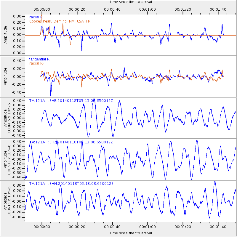
121A Cookes Peak, Deming, NM, USA - Earthquake Result Viewer
*The percent match for this event was below the threshold and hence no stack was calculated.
| Earthquake location: |
Bonin Islands, Japan Region |
| Earthquake latitude/longitude: |
28.9/142.3 |
| Earthquake time(UTC): |
2014/01/18 (018) 05:00:43 GMT |
| Earthquake Depth: |
18 km |
| Earthquake Magnitude: |
5.5 MW |
| Earthquake Catalog/Contributor: |
ISC/ISC |
|
| Network: |
TA USArray Transportable Network (new EarthScope stations) |
| Station: |
121A Cookes Peak, Deming, NM, USA |
| Lat/Lon: |
32.53 N/107.79 W |
| Elevation: |
1652 m |
|
| Distance: |
89.7 deg |
| Az: |
52.592 deg |
| Baz: |
304.493 deg |
| Ray Param: |
$rayparam |
*The percent match for this event was below the threshold and hence was not used in the summary stack. |
|
| Radial Match: |
54.396397 % |
| Radial Bump: |
400 |
| Transverse Match: |
66.96342 % |
| Transverse Bump: |
400 |
| SOD ConfigId: |
3390531 |
| Insert Time: |
2019-04-10 00:54:18.579 +0000 |
| GWidth: |
2.5 |
| Max Bumps: |
400 |
| Tol: |
0.001 |
|
Signal To Noise
| Channel | StoN | STA | LTA |
| TA:121A: :BHZ:20140118T05:13:08.650012Z | 0.3797005 | 7.4671874E-8 | 1.9665993E-7 |
| TA:121A: :BHN:20140118T05:13:08.650012Z | 0.46266642 | 6.9067994E-8 | 1.4928249E-7 |
| TA:121A: :BHE:20140118T05:13:08.650012Z | 2.2234347 | 2.674248E-7 | 1.2027554E-7 |
| Arrivals |
| Ps | |
| PpPs | |
| PsPs/PpSs | |


