You are here: Home > Network List > UW - Pacific Northwest Regional Seismic Network Stations List
> Station WOLL Wollman Farm, Schrag, WA, USA > Earthquake Result Viewer
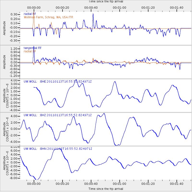
WOLL Wollman Farm, Schrag, WA, USA - Earthquake Result Viewer
*The percent match for this event was below the threshold and hence no stack was calculated.
| Earthquake location: |
Loyalty Islands |
| Earthquake latitude/longitude: |
-20.6/168.4 |
| Earthquake time(UTC): |
2011/01/13 (013) 16:43:07 GMT |
| Earthquake Depth: |
10 km |
| Earthquake Magnitude: |
5.9 MB, 5.9 MW |
| Earthquake Catalog/Contributor: |
WHDF/NEIC |
|
| Network: |
UW Pacific Northwest Regional Seismic Network |
| Station: |
WOLL Wollman Farm, Schrag, WA, USA |
| Lat/Lon: |
47.06 N/118.92 W |
| Elevation: |
385 m |
|
| Distance: |
93.7 deg |
| Az: |
40.85 deg |
| Baz: |
243.662 deg |
| Ray Param: |
$rayparam |
*The percent match for this event was below the threshold and hence was not used in the summary stack. |
|
| Radial Match: |
53.28347 % |
| Radial Bump: |
400 |
| Transverse Match: |
51.003693 % |
| Transverse Bump: |
400 |
| SOD ConfigId: |
346946 |
| Insert Time: |
2011-07-09 12:17:17.738 +0000 |
| GWidth: |
2.5 |
| Max Bumps: |
400 |
| Tol: |
0.001 |
|
Signal To Noise
| Channel | StoN | STA | LTA |
| UW:WOLL: :BHZ:20110113T16:55:52.824971Z | 2.0780776 | 2.6528298E-6 | 1.2765789E-6 |
| UW:WOLL: :BHN:20110113T16:55:52.824971Z | 5.4796987 | 1.02869635E-5 | 1.8772863E-6 |
| UW:WOLL: :BHE:20110113T16:55:52.824971Z | 2.4541564 | 4.164328E-6 | 1.696847E-6 |
| Arrivals |
| Ps | |
| PpPs | |
| PsPs/PpSs | |


