You are here: Home > Network List > TA - USArray Transportable Network (new EarthScope stations) Stations List
> Station N02D Trinity Center, CA, USA > Earthquake Result Viewer
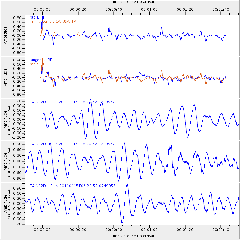
N02D Trinity Center, CA, USA - Earthquake Result Viewer
*The percent match for this event was below the threshold and hence no stack was calculated.
| Earthquake location: |
Vanuatu Islands |
| Earthquake latitude/longitude: |
-14.6/167.3 |
| Earthquake time(UTC): |
2011/01/15 (015) 06:09:10 GMT |
| Earthquake Depth: |
198 km |
| Earthquake Magnitude: |
5.8 MW, 5.4 MB |
| Earthquake Catalog/Contributor: |
WHDF/NEIC |
|
| Network: |
TA USArray Transportable Network (new EarthScope stations) |
| Station: |
N02D Trinity Center, CA, USA |
| Lat/Lon: |
40.97 N/122.71 W |
| Elevation: |
937 m |
|
| Distance: |
85.0 deg |
| Az: |
45.584 deg |
| Baz: |
245.967 deg |
| Ray Param: |
$rayparam |
*The percent match for this event was below the threshold and hence was not used in the summary stack. |
|
| Radial Match: |
45.184834 % |
| Radial Bump: |
400 |
| Transverse Match: |
64.05306 % |
| Transverse Bump: |
400 |
| SOD ConfigId: |
346946 |
| Insert Time: |
2011-07-12 06:59:29.345 +0000 |
| GWidth: |
2.5 |
| Max Bumps: |
400 |
| Tol: |
0.001 |
|
Signal To Noise
| Channel | StoN | STA | LTA |
| TA:N02D: :BHZ:20110115T06:20:52.074995Z | 2.3394563 | 5.8026933E-7 | 2.4803597E-7 |
| TA:N02D: :BHN:20110115T06:20:52.074995Z | 0.78716195 | 2.742865E-7 | 3.4844987E-7 |
| TA:N02D: :BHE:20110115T06:20:52.074995Z | 2.1754875 | 8.670795E-7 | 3.9856792E-7 |
| Arrivals |
| Ps | |
| PpPs | |
| PsPs/PpSs | |


