You are here: Home > Network List > IW - Intermountain West Stations List
> Station MOOW Moose Ponds, Wyoming, USA > Earthquake Result Viewer
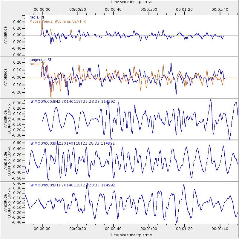
MOOW Moose Ponds, Wyoming, USA - Earthquake Result Viewer
*The percent match for this event was below the threshold and hence no stack was calculated.
| Earthquake location: |
Northern Mid-Atlantic Ridge |
| Earthquake latitude/longitude: |
26.3/-44.4 |
| Earthquake time(UTC): |
2014/01/18 (018) 22:19:28 GMT |
| Earthquake Depth: |
11 km |
| Earthquake Magnitude: |
5.4 MW |
| Earthquake Catalog/Contributor: |
ISC/ISC |
|
| Network: |
IW Intermountain West |
| Station: |
MOOW Moose Ponds, Wyoming, USA |
| Lat/Lon: |
43.75 N/110.74 W |
| Elevation: |
2128 m |
|
| Distance: |
55.6 deg |
| Az: |
306.436 deg |
| Baz: |
85.037 deg |
| Ray Param: |
$rayparam |
*The percent match for this event was below the threshold and hence was not used in the summary stack. |
|
| Radial Match: |
69.01507 % |
| Radial Bump: |
400 |
| Transverse Match: |
45.5785 % |
| Transverse Bump: |
400 |
| SOD ConfigId: |
3390531 |
| Insert Time: |
2019-04-10 01:02:43.503 +0000 |
| GWidth: |
2.5 |
| Max Bumps: |
400 |
| Tol: |
0.001 |
|
Signal To Noise
| Channel | StoN | STA | LTA |
| IW:MOOW:00:BHZ:20140118T22:28:33.11499Z | 1.5910287 | 3.110707E-7 | 1.9551544E-7 |
| IW:MOOW:00:BH1:20140118T22:28:33.11499Z | 0.34695163 | 5.6440218E-8 | 1.626746E-7 |
| IW:MOOW:00:BH2:20140118T22:28:33.11499Z | 0.8890432 | 1.1503751E-7 | 1.2939472E-7 |
| Arrivals |
| Ps | |
| PpPs | |
| PsPs/PpSs | |


