You are here: Home > Network List > IW - Intermountain West Stations List
> Station MOOW Moose Ponds, Wyoming, USA > Earthquake Result Viewer
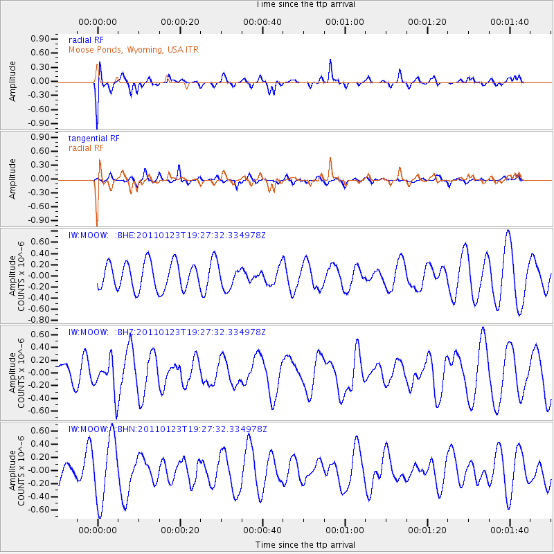
MOOW Moose Ponds, Wyoming, USA - Earthquake Result Viewer
*The percent match for this event was below the threshold and hence no stack was calculated.
| Earthquake location: |
Fiji Islands Region |
| Earthquake latitude/longitude: |
-20.3/-176.3 |
| Earthquake time(UTC): |
2011/01/23 (023) 19:15:42 GMT |
| Earthquake Depth: |
236 km |
| Earthquake Magnitude: |
5.7 MB, 5.9 MW, 5.9 MW |
| Earthquake Catalog/Contributor: |
WHDF/NEIC |
|
| Network: |
IW Intermountain West |
| Station: |
MOOW Moose Ponds, Wyoming, USA |
| Lat/Lon: |
43.75 N/110.74 W |
| Elevation: |
2128 m |
|
| Distance: |
87.5 deg |
| Az: |
41.324 deg |
| Baz: |
238.767 deg |
| Ray Param: |
$rayparam |
*The percent match for this event was below the threshold and hence was not used in the summary stack. |
|
| Radial Match: |
65.91164 % |
| Radial Bump: |
400 |
| Transverse Match: |
39.429726 % |
| Transverse Bump: |
357 |
| SOD ConfigId: |
346946 |
| Insert Time: |
2011-07-14 07:13:41.961 +0000 |
| GWidth: |
2.5 |
| Max Bumps: |
400 |
| Tol: |
0.001 |
|
Signal To Noise
| Channel | StoN | STA | LTA |
| IW:MOOW: :BHZ:20110123T19:27:32.334978Z | 0.9117622 | 2.6694696E-7 | 2.9278132E-7 |
| IW:MOOW: :BHN:20110123T19:27:32.334978Z | 2.751584 | 5.014874E-7 | 1.8225407E-7 |
| IW:MOOW: :BHE:20110123T19:27:32.334978Z | 0.80317754 | 1.9083693E-7 | 2.3760244E-7 |
| Arrivals |
| Ps | |
| PpPs | |
| PsPs/PpSs | |


