You are here: Home > Network List > TA - USArray Transportable Network (new EarthScope stations) Stations List
> Station 336A Riesel, TX, USA > Earthquake Result Viewer
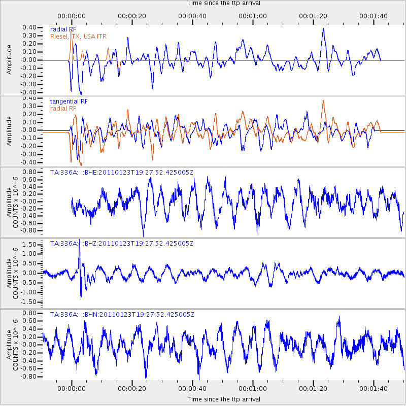
336A Riesel, TX, USA - Earthquake Result Viewer
*The percent match for this event was below the threshold and hence no stack was calculated.
| Earthquake location: |
Fiji Islands Region |
| Earthquake latitude/longitude: |
-20.3/-176.3 |
| Earthquake time(UTC): |
2011/01/23 (023) 19:15:42 GMT |
| Earthquake Depth: |
236 km |
| Earthquake Magnitude: |
5.7 MB, 5.9 MW, 5.9 MW |
| Earthquake Catalog/Contributor: |
WHDF/NEIC |
|
| Network: |
TA USArray Transportable Network (new EarthScope stations) |
| Station: |
336A Riesel, TX, USA |
| Lat/Lon: |
31.39 N/96.84 W |
| Elevation: |
140 m |
|
| Distance: |
91.8 deg |
| Az: |
57.266 deg |
| Baz: |
247.374 deg |
| Ray Param: |
$rayparam |
*The percent match for this event was below the threshold and hence was not used in the summary stack. |
|
| Radial Match: |
50.995438 % |
| Radial Bump: |
400 |
| Transverse Match: |
60.1324 % |
| Transverse Bump: |
400 |
| SOD ConfigId: |
346946 |
| Insert Time: |
2011-07-14 07:28:30.682 +0000 |
| GWidth: |
2.5 |
| Max Bumps: |
400 |
| Tol: |
0.001 |
|
Signal To Noise
| Channel | StoN | STA | LTA |
| TA:336A: :BHZ:20110123T19:27:52.425005Z | 3.9558318 | 5.7066916E-7 | 1.4426023E-7 |
| TA:336A: :BHN:20110123T19:27:52.425005Z | 1.8073572 | 3.2673478E-7 | 1.807804E-7 |
| TA:336A: :BHE:20110123T19:27:52.425005Z | 1.1486363 | 2.824041E-7 | 2.4586032E-7 |
| Arrivals |
| Ps | |
| PpPs | |
| PsPs/PpSs | |


