You are here: Home > Network List > TA - USArray Transportable Network (new EarthScope stations) Stations List
> Station D57A Chemin Vers le Barrage, Saint-Michel-Des-Saints, Q > Earthquake Result Viewer
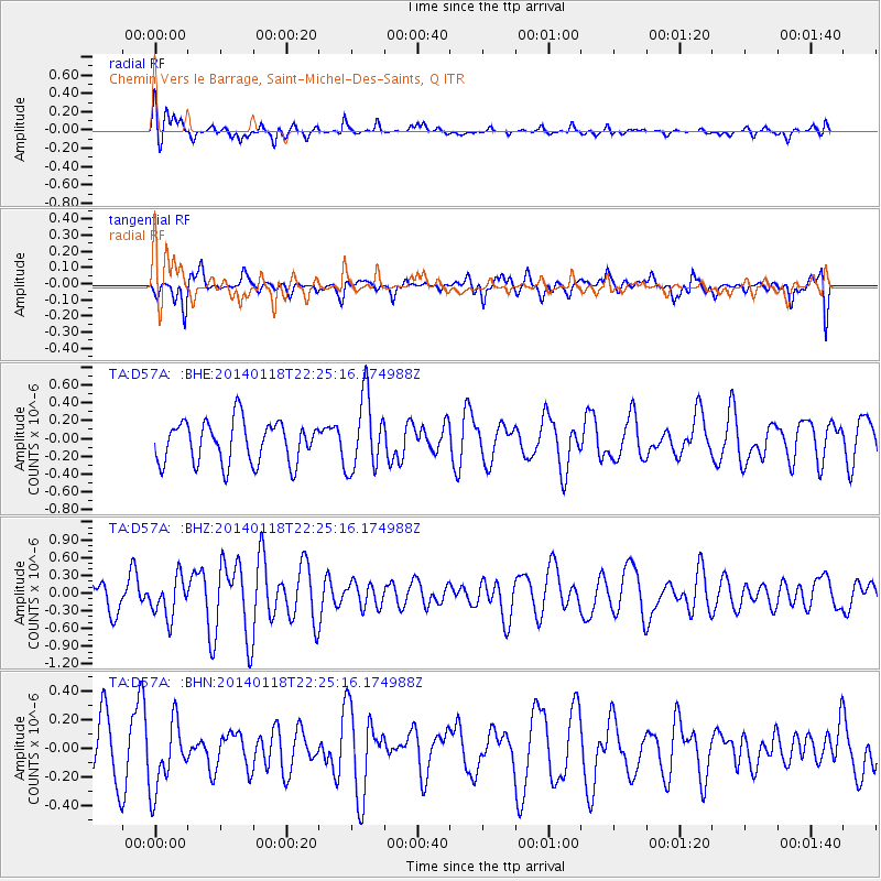
D57A Chemin Vers le Barrage, Saint-Michel-Des-Saints, Q - Earthquake Result Viewer
*The percent match for this event was below the threshold and hence no stack was calculated.
| Earthquake location: |
Northern Mid-Atlantic Ridge |
| Earthquake latitude/longitude: |
26.3/-44.4 |
| Earthquake time(UTC): |
2014/01/18 (018) 22:19:28 GMT |
| Earthquake Depth: |
11 km |
| Earthquake Magnitude: |
5.4 MW |
| Earthquake Catalog/Contributor: |
ISC/ISC |
|
| Network: |
TA USArray Transportable Network (new EarthScope stations) |
| Station: |
D57A Chemin Vers le Barrage, Saint-Michel-Des-Saints, Q |
| Lat/Lon: |
47.02 N/73.89 W |
| Elevation: |
422 m |
|
| Distance: |
31.1 deg |
| Az: |
319.326 deg |
| Baz: |
121.26 deg |
| Ray Param: |
$rayparam |
*The percent match for this event was below the threshold and hence was not used in the summary stack. |
|
| Radial Match: |
53.64809 % |
| Radial Bump: |
365 |
| Transverse Match: |
57.149 % |
| Transverse Bump: |
386 |
| SOD ConfigId: |
3390531 |
| Insert Time: |
2019-04-10 01:04:29.697 +0000 |
| GWidth: |
2.5 |
| Max Bumps: |
400 |
| Tol: |
0.001 |
|
Signal To Noise
| Channel | StoN | STA | LTA |
| TA:D57A: :BHZ:20140118T22:25:16.174988Z | 1.4049586 | 3.3402017E-7 | 2.3774379E-7 |
| TA:D57A: :BHN:20140118T22:25:16.174988Z | 1.3633505 | 2.4315693E-7 | 1.7835248E-7 |
| TA:D57A: :BHE:20140118T22:25:16.174988Z | 1.7649333 | 4.1253128E-7 | 2.3373758E-7 |
| Arrivals |
| Ps | |
| PpPs | |
| PsPs/PpSs | |


