You are here: Home > Network List > CI - Caltech Regional Seismic Network Stations List
> Station BFS Mt Baldy Forest Station > Earthquake Result Viewer
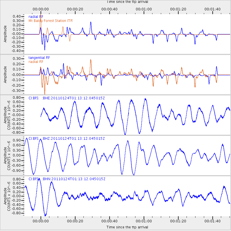
BFS Mt Baldy Forest Station - Earthquake Result Viewer
*The percent match for this event was below the threshold and hence no stack was calculated.
| Earthquake location: |
Tonga Islands |
| Earthquake latitude/longitude: |
-19.2/-173.5 |
| Earthquake time(UTC): |
2011/01/24 (024) 01:02:02 GMT |
| Earthquake Depth: |
16 km |
| Earthquake Magnitude: |
5.5 MB, 5.8 MS, 5.7 MW, 5.7 MW |
| Earthquake Catalog/Contributor: |
WHDF/NEIC |
|
| Network: |
CI Caltech Regional Seismic Network |
| Station: |
BFS Mt Baldy Forest Station |
| Lat/Lon: |
34.24 N/117.66 W |
| Elevation: |
1312 m |
|
| Distance: |
75.1 deg |
| Az: |
45.179 deg |
| Baz: |
234.012 deg |
| Ray Param: |
$rayparam |
*The percent match for this event was below the threshold and hence was not used in the summary stack. |
|
| Radial Match: |
73.98811 % |
| Radial Bump: |
400 |
| Transverse Match: |
50.133648 % |
| Transverse Bump: |
307 |
| SOD ConfigId: |
346946 |
| Insert Time: |
2011-07-14 07:43:24.163 +0000 |
| GWidth: |
2.5 |
| Max Bumps: |
400 |
| Tol: |
0.001 |
|
Signal To Noise
| Channel | StoN | STA | LTA |
| CI:BFS: :BHZ:20110124T01:13:12.045015Z | 1.4106625 | 7.2026666E-7 | 5.105875E-7 |
| CI:BFS: :BHN:20110124T01:13:12.045015Z | 2.1040707 | 6.215243E-7 | 2.9539137E-7 |
| CI:BFS: :BHE:20110124T01:13:12.045015Z | 1.037943 | 3.159624E-7 | 3.0441208E-7 |
| Arrivals |
| Ps | |
| PpPs | |
| PsPs/PpSs | |


