You are here: Home > Network List > TA - USArray Transportable Network (new EarthScope stations) Stations List
> Station Y38A Idabel, OK, USA > Earthquake Result Viewer
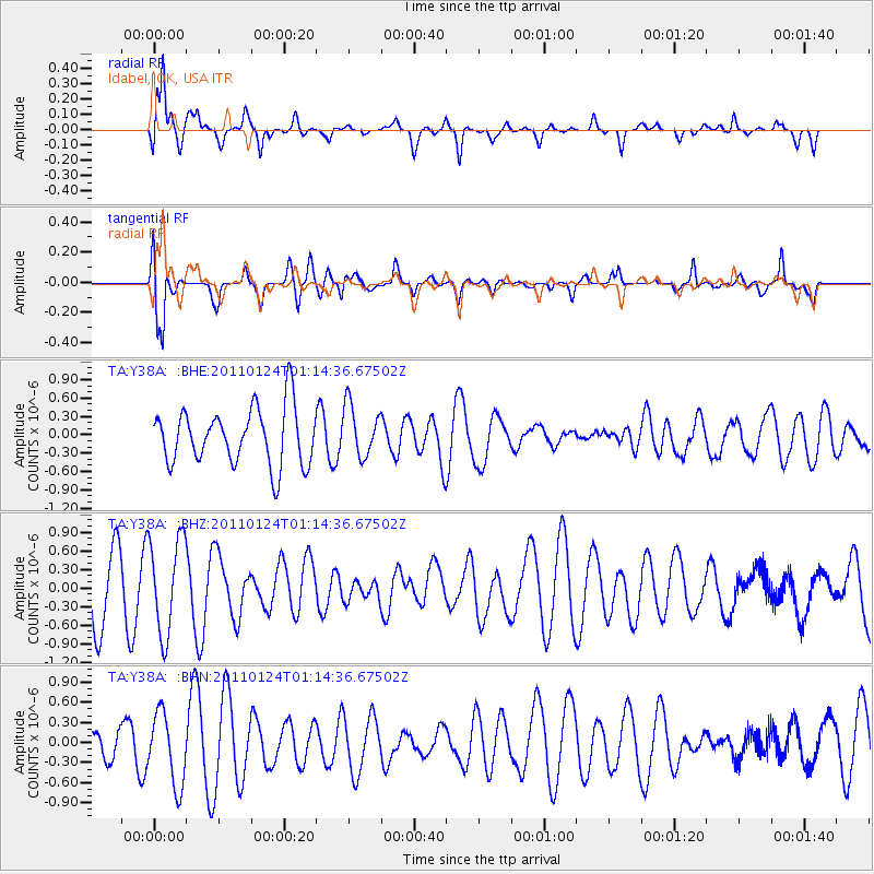
Y38A Idabel, OK, USA - Earthquake Result Viewer
*The percent match for this event was below the threshold and hence no stack was calculated.
| Earthquake location: |
Tonga Islands |
| Earthquake latitude/longitude: |
-19.2/-173.5 |
| Earthquake time(UTC): |
2011/01/24 (024) 01:02:02 GMT |
| Earthquake Depth: |
16 km |
| Earthquake Magnitude: |
5.5 MB, 5.8 MS, 5.7 MW, 5.7 MW |
| Earthquake Catalog/Contributor: |
WHDF/NEIC |
|
| Network: |
TA USArray Transportable Network (new EarthScope stations) |
| Station: |
Y38A Idabel, OK, USA |
| Lat/Lon: |
33.93 N/94.73 W |
| Elevation: |
118 m |
|
| Distance: |
91.6 deg |
| Az: |
54.678 deg |
| Baz: |
248.026 deg |
| Ray Param: |
$rayparam |
*The percent match for this event was below the threshold and hence was not used in the summary stack. |
|
| Radial Match: |
75.312 % |
| Radial Bump: |
400 |
| Transverse Match: |
61.788364 % |
| Transverse Bump: |
400 |
| SOD ConfigId: |
346946 |
| Insert Time: |
2011-07-14 07:49:04.348 +0000 |
| GWidth: |
2.5 |
| Max Bumps: |
400 |
| Tol: |
0.001 |
|
Signal To Noise
| Channel | StoN | STA | LTA |
| TA:Y38A: :BHZ:20110124T01:14:36.67502Z | 1.3567498 | 7.720693E-7 | 5.69058E-7 |
| TA:Y38A: :BHN:20110124T01:14:36.67502Z | 2.1965191 | 5.355919E-7 | 2.4383667E-7 |
| TA:Y38A: :BHE:20110124T01:14:36.67502Z | 0.919435 | 4.2486204E-7 | 4.6209033E-7 |
| Arrivals |
| Ps | |
| PpPs | |
| PsPs/PpSs | |


