You are here: Home > Network List > TA - USArray Transportable Network (new EarthScope stations) Stations List
> Station P54A Burton, WV, USA > Earthquake Result Viewer
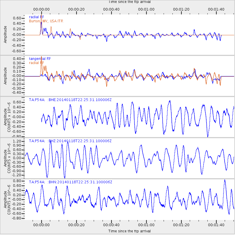
P54A Burton, WV, USA - Earthquake Result Viewer
*The percent match for this event was below the threshold and hence no stack was calculated.
| Earthquake location: |
Northern Mid-Atlantic Ridge |
| Earthquake latitude/longitude: |
26.3/-44.4 |
| Earthquake time(UTC): |
2014/01/18 (018) 22:19:28 GMT |
| Earthquake Depth: |
11 km |
| Earthquake Magnitude: |
5.4 MW |
| Earthquake Catalog/Contributor: |
ISC/ISC |
|
| Network: |
TA USArray Transportable Network (new EarthScope stations) |
| Station: |
P54A Burton, WV, USA |
| Lat/Lon: |
39.61 N/80.48 W |
| Elevation: |
473 m |
|
| Distance: |
32.8 deg |
| Az: |
302.916 deg |
| Baz: |
102.788 deg |
| Ray Param: |
$rayparam |
*The percent match for this event was below the threshold and hence was not used in the summary stack. |
|
| Radial Match: |
62.09443 % |
| Radial Bump: |
400 |
| Transverse Match: |
39.28626 % |
| Transverse Bump: |
400 |
| SOD ConfigId: |
3390531 |
| Insert Time: |
2019-04-10 01:05:10.869 +0000 |
| GWidth: |
2.5 |
| Max Bumps: |
400 |
| Tol: |
0.001 |
|
Signal To Noise
| Channel | StoN | STA | LTA |
| TA:P54A: :BHZ:20140118T22:25:31.100006Z | 2.6212304 | 6.9288416E-7 | 2.6433545E-7 |
| TA:P54A: :BHN:20140118T22:25:31.100006Z | 0.928482 | 3.0498165E-7 | 3.2847342E-7 |
| TA:P54A: :BHE:20140118T22:25:31.100006Z | 0.640879 | 1.5319159E-7 | 2.3903357E-7 |
| Arrivals |
| Ps | |
| PpPs | |
| PsPs/PpSs | |


