You are here: Home > Network List > TA - USArray Transportable Network (new EarthScope stations) Stations List
> Station D35A Remer, MN, USA > Earthquake Result Viewer
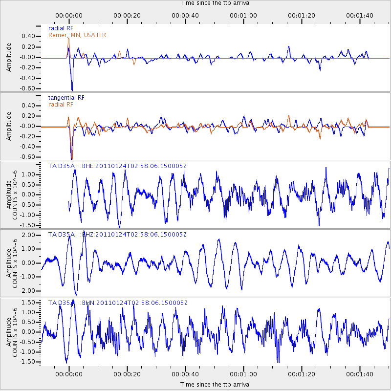
D35A Remer, MN, USA - Earthquake Result Viewer
*The percent match for this event was below the threshold and hence no stack was calculated.
| Earthquake location: |
Tajikistan |
| Earthquake latitude/longitude: |
38.4/72.8 |
| Earthquake time(UTC): |
2011/01/24 (024) 02:45:31 GMT |
| Earthquake Depth: |
110 km |
| Earthquake Magnitude: |
6.0 MB, 6.1 MW, 6.0 MW |
| Earthquake Catalog/Contributor: |
WHDF/NEIC |
|
| Network: |
TA USArray Transportable Network (new EarthScope stations) |
| Station: |
D35A Remer, MN, USA |
| Lat/Lon: |
47.08 N/94.05 W |
| Elevation: |
427 m |
|
| Distance: |
94.1 deg |
| Az: |
351.029 deg |
| Baz: |
10.326 deg |
| Ray Param: |
$rayparam |
*The percent match for this event was below the threshold and hence was not used in the summary stack. |
|
| Radial Match: |
75.90531 % |
| Radial Bump: |
400 |
| Transverse Match: |
72.63723 % |
| Transverse Bump: |
400 |
| SOD ConfigId: |
346946 |
| Insert Time: |
2011-07-14 08:09:16.148 +0000 |
| GWidth: |
2.5 |
| Max Bumps: |
400 |
| Tol: |
0.001 |
|
Signal To Noise
| Channel | StoN | STA | LTA |
| TA:D35A: :BHZ:20110124T02:58:06.150005Z | 2.9629128 | 1.3300294E-6 | 4.4889254E-7 |
| TA:D35A: :BHN:20110124T02:58:06.150005Z | 1.772162 | 1.0545081E-6 | 5.9504043E-7 |
| TA:D35A: :BHE:20110124T02:58:06.150005Z | 0.9783727 | 6.702806E-7 | 6.850974E-7 |
| Arrivals |
| Ps | |
| PpPs | |
| PsPs/PpSs | |


