KBK KN.KBK - Earthquake Result Viewer
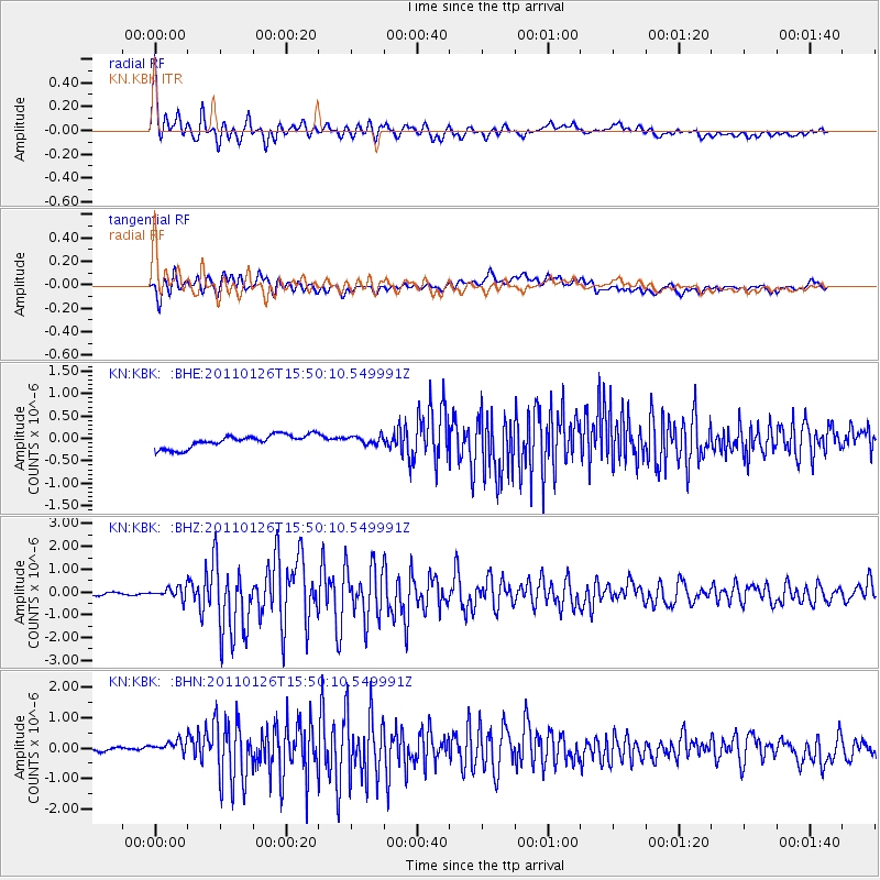
Earthquake location: Northern Sumatra, Indonesia
Earthquake latitude/longitude: 2.2/96.8
Earthquake time(UTC): 2011/01/26 (026) 15:42:29 GMT
Earthquake Depth: 23 km
Earthquake Magnitude: 5.8 MB, 5.9 MS, 6.1 MW, 5.9 MW
Earthquake Catalog/Contributor: WHDF/NEIC
Network: KN Kyrgyz Seismic Telemetry Network
Station: KBK KN.KBK
Lat/Lon: 42.66 N/74.95 E
Elevation: 1760 m
Distance: 44.8 deg
Az: 337.025 deg
Baz: 148.08 deg
Ray Param: 0.07167354
Estimated Moho Depth: 16.5 km
Estimated Crust Vp/Vs: 1.94
Assumed Crust Vp: 6.306 km/s
Estimated Crust Vs: 3.255 km/s
Estimated Crust Poisson's Ratio: 0.32
Radial Match: 93.25599 %
Radial Bump: 400
Transverse Match: 82.03188 %
Transverse Bump: 400
SOD ConfigId: 346946
Insert Time: 2011-07-14 08:18:37.628 +0000
GWidth: 2.5
Max Bumps: 400
Tol: 0.001

Signal To Noise

ChannelStoNSTALTA
KN:KBK: :BHZ:20110126T15:50:10.549991Z3.23597432.4267587E-77.499314E-8
KN:KBK: :BHN:20110126T15:50:10.549991Z2.40074182.9748438E-71.2391352E-7
KN:KBK: :BHE:20110126T15:50:10.549991Z0.61035998.8080725E-81.4430948E-7
Arrivals
Ps2.6 SECOND
PpPs7.3 SECOND
PsPs/PpSs9.9 SECOND