You are here: Home > Network List > KN - Kyrgyz Seismic Telemetry Network Stations List
> Station ULHL KN.ULHL > Earthquake Result Viewer
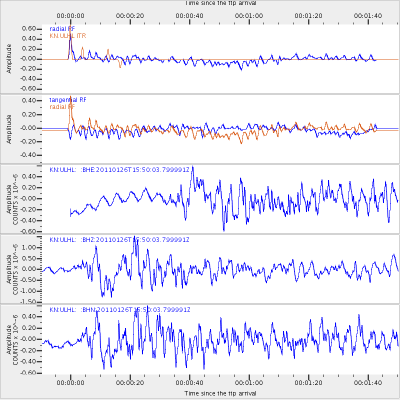
ULHL KN.ULHL - Earthquake Result Viewer
*The percent match for this event was below the threshold and hence no stack was calculated.
| Earthquake location: |
Northern Sumatra, Indonesia |
| Earthquake latitude/longitude: |
2.2/96.8 |
| Earthquake time(UTC): |
2011/01/26 (026) 15:42:29 GMT |
| Earthquake Depth: |
23 km |
| Earthquake Magnitude: |
5.8 MB, 5.9 MS, 6.1 MW, 5.9 MW |
| Earthquake Catalog/Contributor: |
WHDF/NEIC |
|
| Network: |
KN Kyrgyz Seismic Telemetry Network |
| Station: |
ULHL KN.ULHL |
| Lat/Lon: |
42.25 N/76.24 E |
| Elevation: |
2040 m |
|
| Distance: |
43.9 deg |
| Az: |
337.893 deg |
| Baz: |
149.571 deg |
| Ray Param: |
$rayparam |
*The percent match for this event was below the threshold and hence was not used in the summary stack. |
|
| Radial Match: |
73.22649 % |
| Radial Bump: |
400 |
| Transverse Match: |
56.44202 % |
| Transverse Bump: |
400 |
| SOD ConfigId: |
346946 |
| Insert Time: |
2011-07-14 08:19:05.875 +0000 |
| GWidth: |
2.5 |
| Max Bumps: |
400 |
| Tol: |
0.001 |
|
Signal To Noise
| Channel | StoN | STA | LTA |
| KN:ULHL: :BHZ:20110126T15:50:03.799991Z | 2.2571049 | 1.6449027E-7 | 7.287667E-8 |
| KN:ULHL: :BHN:20110126T15:50:03.799991Z | 1.0297194 | 1.103851E-7 | 1.0719921E-7 |
| KN:ULHL: :BHE:20110126T15:50:03.799991Z | 0.7618841 | 9.105748E-8 | 1.1951617E-7 |
| Arrivals |
| Ps | |
| PpPs | |
| PsPs/PpSs | |


