You are here: Home > Network List > CI - Caltech Regional Seismic Network Stations List
> Station GLA Glamis, Glamis, CA, USA > Earthquake Result Viewer
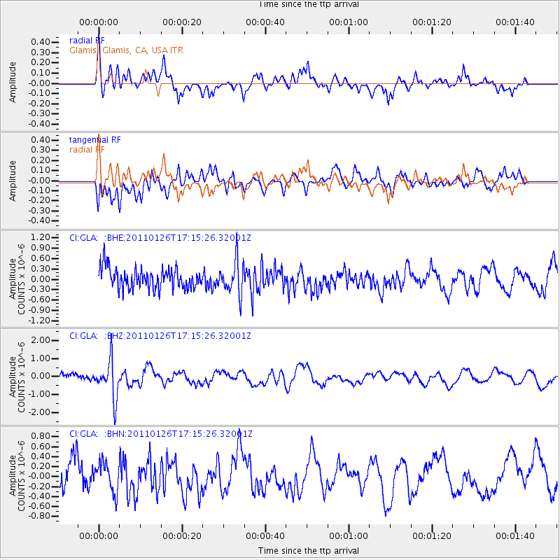
GLA Glamis, Glamis, CA, USA - Earthquake Result Viewer
*The percent match for this event was below the threshold and hence no stack was calculated.
| Earthquake location: |
Santa Cruz Islands |
| Earthquake latitude/longitude: |
-11.0/166.3 |
| Earthquake time(UTC): |
2011/01/26 (026) 17:03:30 GMT |
| Earthquake Depth: |
148 km |
| Earthquake Magnitude: |
5.8 MB, 5.7 MW |
| Earthquake Catalog/Contributor: |
WHDF/NEIC |
|
| Network: |
CI Caltech Regional Seismic Network |
| Station: |
GLA Glamis, Glamis, CA, USA |
| Lat/Lon: |
33.05 N/114.83 W |
| Elevation: |
610 m |
|
| Distance: |
86.8 deg |
| Az: |
55.624 deg |
| Baz: |
254.77 deg |
| Ray Param: |
$rayparam |
*The percent match for this event was below the threshold and hence was not used in the summary stack. |
|
| Radial Match: |
63.173157 % |
| Radial Bump: |
400 |
| Transverse Match: |
54.984875 % |
| Transverse Bump: |
400 |
| SOD ConfigId: |
346946 |
| Insert Time: |
2011-07-14 08:30:07.944 +0000 |
| GWidth: |
2.5 |
| Max Bumps: |
400 |
| Tol: |
0.001 |
|
Signal To Noise
| Channel | StoN | STA | LTA |
| CI:GLA: :BHZ:20110126T17:15:26.32001Z | 4.463112 | 1.0693313E-6 | 2.3959322E-7 |
| CI:GLA: :BHN:20110126T17:15:26.32001Z | 1.0257394 | 2.9565848E-7 | 2.8823936E-7 |
| CI:GLA: :BHE:20110126T17:15:26.32001Z | 1.6791807 | 4.844771E-7 | 2.885199E-7 |
| Arrivals |
| Ps | |
| PpPs | |
| PsPs/PpSs | |


