You are here: Home > Network List > G - GEOSCOPE Stations List
> Station INU Inuyama, Japan > Earthquake Result Viewer
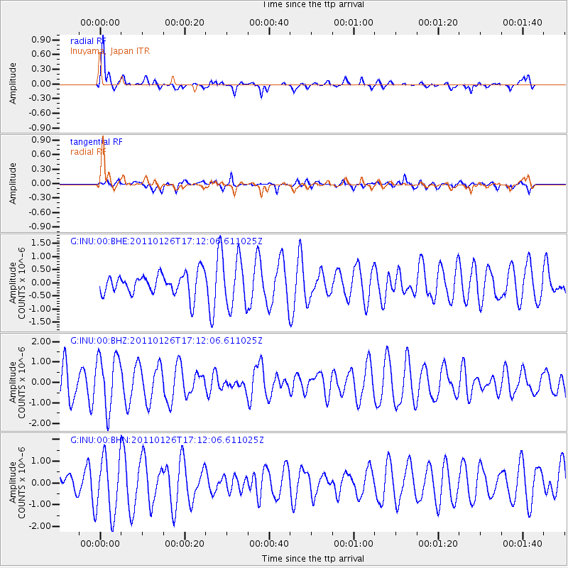
INU Inuyama, Japan - Earthquake Result Viewer
*The percent match for this event was below the threshold and hence no stack was calculated.
| Earthquake location: |
Santa Cruz Islands |
| Earthquake latitude/longitude: |
-11.0/166.3 |
| Earthquake time(UTC): |
2011/01/26 (026) 17:03:30 GMT |
| Earthquake Depth: |
148 km |
| Earthquake Magnitude: |
5.8 MB, 5.7 MW |
| Earthquake Catalog/Contributor: |
WHDF/NEIC |
|
| Network: |
G GEOSCOPE |
| Station: |
INU Inuyama, Japan |
| Lat/Lon: |
35.35 N/137.03 E |
| Elevation: |
132 m |
|
| Distance: |
53.8 deg |
| Az: |
330.302 deg |
| Baz: |
143.484 deg |
| Ray Param: |
$rayparam |
*The percent match for this event was below the threshold and hence was not used in the summary stack. |
|
| Radial Match: |
75.42159 % |
| Radial Bump: |
400 |
| Transverse Match: |
56.389896 % |
| Transverse Bump: |
400 |
| SOD ConfigId: |
346946 |
| Insert Time: |
2011-07-14 08:35:36.909 +0000 |
| GWidth: |
2.5 |
| Max Bumps: |
400 |
| Tol: |
0.001 |
|
Signal To Noise
| Channel | StoN | STA | LTA |
| G:INU:00:BHZ:20110126T17:12:06.611025Z | 1.3714272 | 1.3346943E-6 | 9.732156E-7 |
| G:INU:00:BHN:20110126T17:12:06.611025Z | 1.8796602 | 1.32283E-6 | 7.037601E-7 |
| G:INU:00:BHE:20110126T17:12:06.611025Z | 2.231886 | 9.005137E-7 | 4.0347658E-7 |
| Arrivals |
| Ps | |
| PpPs | |
| PsPs/PpSs | |


