You are here: Home > Network List > TA - USArray Transportable Network (new EarthScope stations) Stations List
> Station N02D Trinity Center, CA, USA > Earthquake Result Viewer
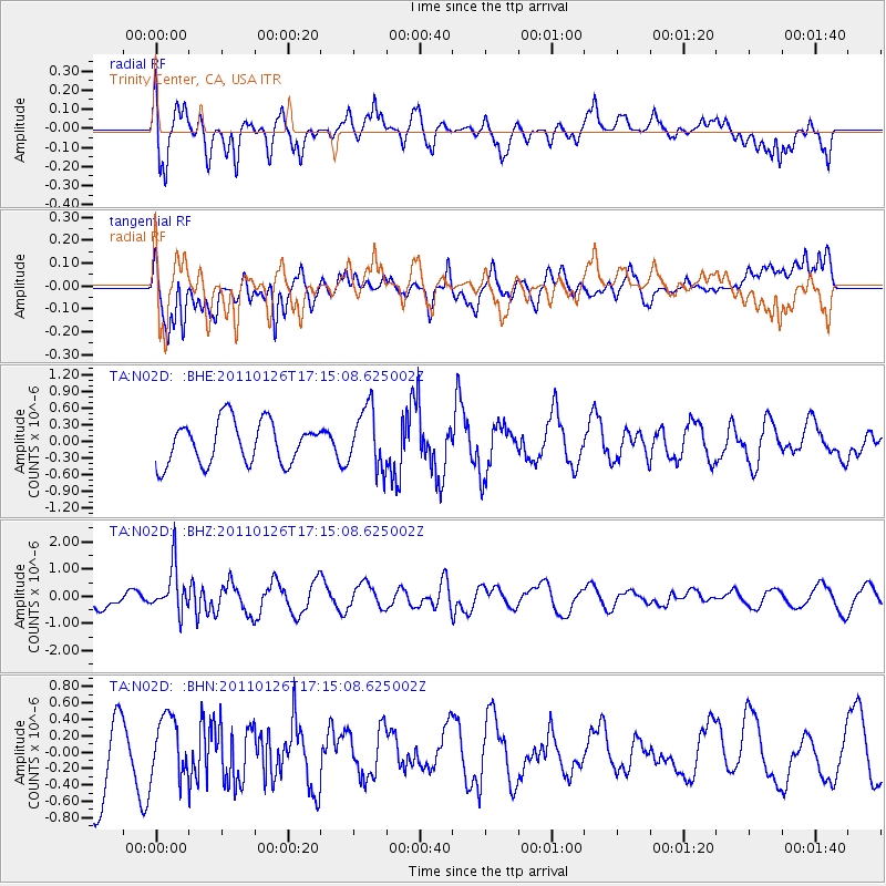
N02D Trinity Center, CA, USA - Earthquake Result Viewer
*The percent match for this event was below the threshold and hence no stack was calculated.
| Earthquake location: |
Santa Cruz Islands |
| Earthquake latitude/longitude: |
-11.0/166.3 |
| Earthquake time(UTC): |
2011/01/26 (026) 17:03:30 GMT |
| Earthquake Depth: |
148 km |
| Earthquake Magnitude: |
5.8 MB, 5.7 MW |
| Earthquake Catalog/Contributor: |
WHDF/NEIC |
|
| Network: |
TA USArray Transportable Network (new EarthScope stations) |
| Station: |
N02D Trinity Center, CA, USA |
| Lat/Lon: |
40.97 N/122.71 W |
| Elevation: |
937 m |
|
| Distance: |
83.2 deg |
| Az: |
46.133 deg |
| Baz: |
249.202 deg |
| Ray Param: |
$rayparam |
*The percent match for this event was below the threshold and hence was not used in the summary stack. |
|
| Radial Match: |
53.32704 % |
| Radial Bump: |
400 |
| Transverse Match: |
44.82911 % |
| Transverse Bump: |
400 |
| SOD ConfigId: |
346946 |
| Insert Time: |
2011-07-14 08:42:19.618 +0000 |
| GWidth: |
2.5 |
| Max Bumps: |
400 |
| Tol: |
0.001 |
|
Signal To Noise
| Channel | StoN | STA | LTA |
| TA:N02D: :BHZ:20110126T17:15:08.625002Z | 2.9922082 | 8.382847E-7 | 2.8015586E-7 |
| TA:N02D: :BHN:20110126T17:15:08.625002Z | 0.5831433 | 3.5780906E-7 | 6.1358685E-7 |
| TA:N02D: :BHE:20110126T17:15:08.625002Z | 1.4279513 | 5.3985923E-7 | 3.7806555E-7 |
| Arrivals |
| Ps | |
| PpPs | |
| PsPs/PpSs | |


