You are here: Home > Network List > US - United States National Seismic Network Stations List
> Station BOZ Bozeman, Montana, USA > Earthquake Result Viewer
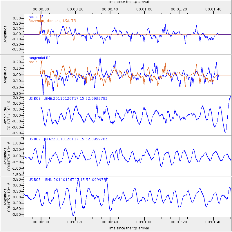
BOZ Bozeman, Montana, USA - Earthquake Result Viewer
*The percent match for this event was below the threshold and hence no stack was calculated.
| Earthquake location: |
Santa Cruz Islands |
| Earthquake latitude/longitude: |
-11.0/166.3 |
| Earthquake time(UTC): |
2011/01/26 (026) 17:03:30 GMT |
| Earthquake Depth: |
148 km |
| Earthquake Magnitude: |
5.8 MB, 5.7 MW |
| Earthquake Catalog/Contributor: |
WHDF/NEIC |
|
| Network: |
US United States National Seismic Network |
| Station: |
BOZ Bozeman, Montana, USA |
| Lat/Lon: |
45.65 N/111.63 W |
| Elevation: |
1589 m |
|
| Distance: |
92.3 deg |
| Az: |
44.053 deg |
| Baz: |
256.709 deg |
| Ray Param: |
$rayparam |
*The percent match for this event was below the threshold and hence was not used in the summary stack. |
|
| Radial Match: |
70.35474 % |
| Radial Bump: |
400 |
| Transverse Match: |
59.78627 % |
| Transverse Bump: |
400 |
| SOD ConfigId: |
346946 |
| Insert Time: |
2011-07-14 08:45:05.603 +0000 |
| GWidth: |
2.5 |
| Max Bumps: |
400 |
| Tol: |
0.001 |
|
Signal To Noise
| Channel | StoN | STA | LTA |
| US:BOZ: :BHZ:20110126T17:15:52.099978Z | 3.5429907 | 7.1774514E-7 | 2.0258173E-7 |
| US:BOZ: :BHN:20110126T17:15:52.099978Z | 1.2130351 | 2.49333E-7 | 2.0554474E-7 |
| US:BOZ: :BHE:20110126T17:15:52.099978Z | 0.9109142 | 2.4130867E-7 | 2.6490824E-7 |
| Arrivals |
| Ps | |
| PpPs | |
| PsPs/PpSs | |


