You are here: Home > Network List > US - United States National Seismic Network Stations List
> Station LONY Lake Ozonia, New York, USA > Earthquake Result Viewer
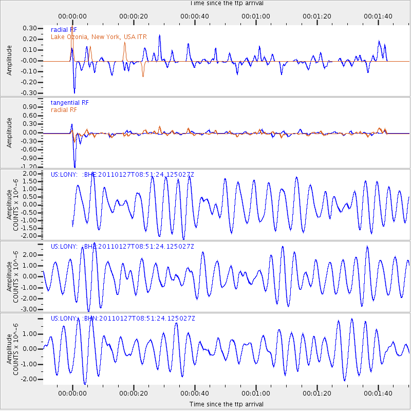
LONY Lake Ozonia, New York, USA - Earthquake Result Viewer
*The percent match for this event was below the threshold and hence no stack was calculated.
| Earthquake location: |
Southern Iran |
| Earthquake latitude/longitude: |
28.2/59.0 |
| Earthquake time(UTC): |
2011/01/27 (027) 08:38:28 GMT |
| Earthquake Depth: |
12 km |
| Earthquake Magnitude: |
5.8 MB, 6.2 MS, 6.2 MW, 6.1 MW |
| Earthquake Catalog/Contributor: |
WHDF/NEIC |
|
| Network: |
US United States National Seismic Network |
| Station: |
LONY Lake Ozonia, New York, USA |
| Lat/Lon: |
44.62 N/74.58 W |
| Elevation: |
440 m |
|
| Distance: |
96.1 deg |
| Az: |
328.661 deg |
| Baz: |
40.004 deg |
| Ray Param: |
$rayparam |
*The percent match for this event was below the threshold and hence was not used in the summary stack. |
|
| Radial Match: |
50.57226 % |
| Radial Bump: |
395 |
| Transverse Match: |
87.73915 % |
| Transverse Bump: |
400 |
| SOD ConfigId: |
346946 |
| Insert Time: |
2011-07-14 08:58:06.347 +0000 |
| GWidth: |
2.5 |
| Max Bumps: |
400 |
| Tol: |
0.001 |
|
Signal To Noise
| Channel | StoN | STA | LTA |
| US:LONY: :BHZ:20110127T08:51:24.125027Z | 2.376832 | 1.6733246E-6 | 7.0401467E-7 |
| US:LONY: :BHN:20110127T08:51:24.125027Z | 1.7268646 | 1.4873668E-6 | 8.6131064E-7 |
| US:LONY: :BHE:20110127T08:51:24.125027Z | 1.5087856 | 1.2551916E-6 | 8.3192174E-7 |
| Arrivals |
| Ps | |
| PpPs | |
| PsPs/PpSs | |


