HWB AZ.HWB - Earthquake Result Viewer
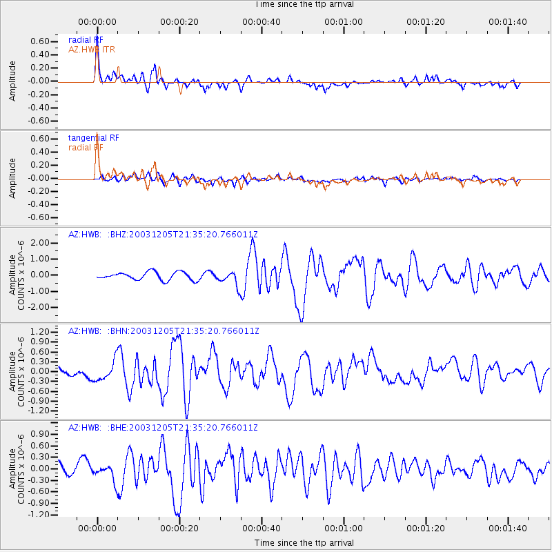
Earthquake location: Komandorskiye Ostrova Region
Earthquake latitude/longitude: 55.5/165.8
Earthquake time(UTC): 2003/12/05 (339) 21:26:09 GMT
Earthquake Depth: 10 km
Earthquake Magnitude: 6.1 MB, 6.5 MS, 6.7 MW, 6.7 MW
Earthquake Catalog/Contributor: WHDF/NEIC
Network: AZ ANZA Regional Network
Station: HWB AZ.HWB
Lat/Lon: 33.03 N/116.96 W
Elevation: 478 m
Distance: 56.5 deg
Az: 79.225 deg
Baz: 318.339 deg
Ray Param: 0.06408624
Estimated Moho Depth: 32.25 km
Estimated Crust Vp/Vs: 1.73
Assumed Crust Vp: 6.264 km/s
Estimated Crust Vs: 3.626 km/s
Estimated Crust Poisson's Ratio: 0.25
Radial Match: 91.11368 %
Radial Bump: 400
Transverse Match: 74.41581 %
Transverse Bump: 400
SOD ConfigId: 32974
Insert Time: 2010-02-26 19:24:21.110 +0000
GWidth: 2.5
Max Bumps: 400
Tol: 0.001

Signal To Noise

ChannelStoNSTALTA
AZ:HWB: :BHN:20031205T21:35:20.766011Z4.26052573.00273E-77.0477924E-8
AZ:HWB: :BHE:20031205T21:35:20.766011Z1.98402382.1182453E-71.0676512E-7
AZ:HWB: :BHZ:20031205T21:35:20.766011Z1.89357154.6954693E-72.4796896E-7
Arrivals
Ps3.9 SECOND
PpPs13 SECOND
PsPs/PpSs17 SECOND