You are here: Home > Network List > AZ - ANZA Regional Network Stations List
> Station SMER AZ.SMER > Earthquake Result Viewer
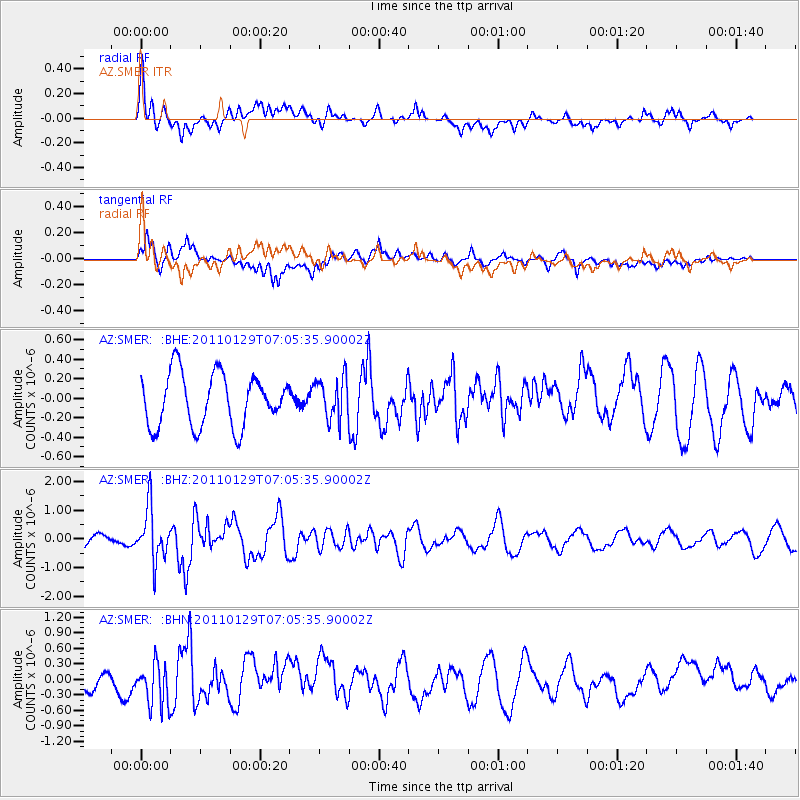
SMER AZ.SMER - Earthquake Result Viewer
*The percent match for this event was below the threshold and hence no stack was calculated.
| Earthquake location: |
Jan Mayen Island Region |
| Earthquake latitude/longitude: |
70.9/-6.7 |
| Earthquake time(UTC): |
2011/01/29 (029) 06:55:26 GMT |
| Earthquake Depth: |
6.0 km |
| Earthquake Magnitude: |
6.1 MB, 6.1 MS, 6.2 MW, 6.2 MW |
| Earthquake Catalog/Contributor: |
WHDF/NEIC |
|
| Network: |
AZ ANZA Regional Network |
| Station: |
SMER AZ.SMER |
| Lat/Lon: |
33.46 N/117.17 W |
| Elevation: |
355 m |
|
| Distance: |
65.0 deg |
| Az: |
300.252 deg |
| Baz: |
19.848 deg |
| Ray Param: |
$rayparam |
*The percent match for this event was below the threshold and hence was not used in the summary stack. |
|
| Radial Match: |
56.015644 % |
| Radial Bump: |
400 |
| Transverse Match: |
65.11721 % |
| Transverse Bump: |
400 |
| SOD ConfigId: |
350818 |
| Insert Time: |
2011-07-20 07:04:57.755 +0000 |
| GWidth: |
2.5 |
| Max Bumps: |
400 |
| Tol: |
0.001 |
|
Signal To Noise
| Channel | StoN | STA | LTA |
| AZ:SMER: :BHZ:20110129T07:05:35.90002Z | 3.048926 | 9.11321E-7 | 2.98899E-7 |
| AZ:SMER: :BHN:20110129T07:05:35.90002Z | 2.4852152 | 4.1077547E-7 | 1.6528769E-7 |
| AZ:SMER: :BHE:20110129T07:05:35.90002Z | 0.8083672 | 2.1529942E-7 | 2.6633865E-7 |
| Arrivals |
| Ps | |
| PpPs | |
| PsPs/PpSs | |


